
Yolo County – List of Stone Quarries, Etc.*
(* Please note: This list does not include gravel or sand quarries.)
- Cadenassa Station (south of), Yolo County, California – Limestone
Deposit (Limestone) (Excerpt from Report XIV
of the State Mineralogist – Mines and Mineral Resources
of Portions of California, Chapters of State Mineralogist’s
Report – Biennial Period 1913-1914, Part II. “The
Counties of Colusa, Glenn, Lake, Marin, Napa, Solano, Sonoma,
Yolo,” by Walter W. Bradley, Field Assistant (field work
in September, 1913), California State Mining Bureau, San Francisco,
California, 1916, pp. 173-370.)
“A deposit of limestone is reported in Secs. 30 and 31, T. 10 N., R. 2 W., 3 miles south of Cadenassa Station, on land owned by E. M. Nash, of Saratoga.”
- Devil’s Gate at Monticello Dam west of Winters,
Yolo County, California – the Putah Creek/Winters Sandstone
Quarry (Sandstone) – The following information
is from Winters: A Heritage of Horticulture, A Harmony of
Purpose, by Joann Leach Larkey, Yolo County Historical
Society, Woodland, CA, 1991, pp. 39.
According to this author, Benoit Bertholet acquired the rock quarry in Putah Canyon in 1882.
- Devil’s Gate at Monticello Dam west of Winters,
Yolo County, California – the
Putah Creek/Winters Sandstone Quarry (circa 1890) (Sandstone) – Excerpts from Tenth Annual Report of the State Mineralogist,
For the Year Ending December 1, 1890, California State
Mining Bureau, Sacramento: State Printing 1890, pp. 773-794.
(This book is available for reading or downloading to your
computer on Google Book
Search - Full View Books.)
Yolo County, by W. L. Watts, Assistant in the Field.
“...The county is traversed by two principal creeks, which rising in the mountains to westward, flow down toward the Sacramento River. These are Cache Creek, which is discharged from Clear Lake in Lake County, and the Putah Creek, which takes its rise in the mountains of Napa, and on part of its course forms the southern boundary of the county. Although these creeks, especially Putah Creek, show considerable volume where they first enter the county, for the greater part of the year their waters dwindle away and disappear before reaching the Sacramento.
“Both Cache and Putah Creeks are torrents during the winter months, cutting their way through cañons before reaching the Sacramento Valley, strewing their beds with waterworn rocks and cobbles, and showing on the cañons’ sides the effects of the violent winter floods. As these streams debouch into the valley at Capay and a few miles west of Winters, respectively, the grade lessens. The Putah Creek enters the valley from amid rolling hills, and the formations of shale, sandstone, and conglomerate in the neighborhood of Winters give place to clay and sand....”
“The extreme western borders of the county are occupied by a portion of the Coast Range, while a tongue of rolling hills, which commences a few miles to the northeast of Cacheville, extends with broadening radius toward the northwest corner of the county....”
Building Stone.
“The only quarry that is worked to any extent in Yolo County is situated at the Devil’s Gate, in Putah Cañon, about nine miles west of Winters, on the north side of Putah Creek. The formation in which the quarry has been opened appears to extend from a southeasterly to a northwesterly direction. The stone is a compact sandstone of various shades of blue and gray; it is of smooth grain, and occasionally shows particles of carbonaceous matter. Where the rock has been quarried, near the road at Devil’s Gate, it appears to be free from pebbles. It splits with a true fracture, and slabs fourteen feet by sixteen inches by ten inches have frequently been taken out. This stone has been used for many years for cemetery and building work, and it appears to wear well. It is said that it was originally intended to build the Capitol at Sacramento of this stone. The strata exposed at the Devil’s Gate quarry are, many of them, twelve or fifteen feet in thickness, and dip to the northeast at an angle of about 65 degrees. In the part of the cañon where the quarry is situated, the Putah Creek has cut through the upturned strata almost at right angles with the formation. In T. 8 N., R. 2 W., M.D.M., a ledge of aragonite similar to the Suisun marble is said to have been discovered....”
Yolo County, by W. A. Goodyear, Geologist, and Assistant in the Field.
“The village of Winters is in Yolo County, being on the left bank of Puta (sic) Creek, which for a considerable distance here forms the boundary between Yolo and Solano Counties.
- Devil’s Gate, Putah
Canyon, Yolo County, California – Putah Creek Quarry
(1892) – Excerpt
from Catalog of the State Museum of California,
Vol. 5, Being the made by the State Mining Bureau,
from September 1, 1890, to March
30, 1897, California State Mining Bureau, California,
1899, pp. 77.
“12838. Quartz – Opaline variety. Winters, Yolo Count, California. B. Bertholet. February 15, 1892.”
- Devil’s Gate, Putah Canyon, Yolo County,
California – Putah Creek Quarry (circa 1896) (Sandstone) -
Excerpt from Thirteenth Report (Second
Biennial) of the State Mineralogist For the Two Years Ending
September 15, 1895, California State Mining Bureau,
Sacramento, 1896, pp. 638.
Yolo County
“Putah Creek Quarry – See our Xth report, page 791.* It is on the north side of Putah Creek, at ‘Devil’s Gate,’ in the southwest corner of the county, at about 200’ elevation. The rock is gray and olive-colored sandstone, principally in massive strata, which dip 65° to 70° NE, and forms a high ridge through which the creek has cut its channel. It has been used to some extent for building purposes and cemetery work. Idle. E. F. Searles, of San Francisco, owner; B. Bertholet, of Winters, superintendent.”
(* For the Tenth Report of the State Mineralogist, see above - 1890.)
- Devil’s Gate, Putah Canyon, Yolo County,
California - Putah Creek Property Owned by E. F. Searles,
Tax Rolls Book for 1904, pp. 321, viewed at
the Yolo County Archives, Woodland, California.
“E. F. Searles, Road District 5, Apricot School District. That portion of Putah Creek of NW part of SW of northeast corner of Putah Creek. owned 20 acres, value of land $60, no improvements.
- Devil’s Gate, Putah Canyon, Yolo County (southwest
corner), California – the
Putah Stone Quarry (circa 1906) (Sandstone) (From The
Structural and Industrial Materials of California, Bulletin
No. 38,
California, State Mining Bureau, San
Francisco, California, 1906.)
“Putah Stone Quarry, in Sec. 29, T. 8 N., R. 2 W.; E. F. Searles, San Francisco, owner, B. Berthelot, Winters, Lessee. In the extreme southwest corner of Yolo County, 9 miles by wagon road from Winters; 15 miles by wagon road from Vacaville, Solano County. This deposit of sandstone is situate on the north bank of Putah Creek, and is exposed in heights varying from 50 to 200 feet for a width of one quarter to one half mile. The formation extends east to south across Putah Creek into Solano County. The exposed material at the Putah quarry is shattered but massive. It is blue and gray in color, takes a fine finish, and averages 174 pounds to the cubic foot.”
- Devil’s Gate, Putah Creek property - 1907
Indenture made between Edward F. Searles and W. J. Cannedy in
Yolo County Deed Book 69, pp. 487, viewed at the Yolo County
Archives, Woodland, California.
“This Indenture made the 7th day of December 1907 between Edward F. Searles of the state of Massachusetts and W. J. Cannedy of California...the northeast quarter ¼ of Sec. 29.”
- Devil’s Gate, Putah Canyon, (west of Winters),
Yolo County, California – Putah Creek Quarry (circa
1913) (Sandstone) (Excerpt
from Report XIV of the State Mineralogist – Mines
and Mineral Resources of Portions of California, Chapters
of State Mineralogist’s Report – Biennial Period
1913-1914, Part II. “The Counties of Colusa,
Glenn, Lake, Marin, Napa, Solano, Sonoma, Yolo,” by
Walter W. Bradley, Field
Assistant (field work in
September, 1913), California
State Mining Bureau, San
Francisco, California, 1916,
pp. 173-370.)
“Putah Creek Quarry. E. F. Searles, San Francisco, owner, in Sec. 29, T. 8 N., R. 2 W., 9 miles west of Winters. The Michael Building (1895) Woodland, and several in Winters are constructed of stone from this quarry, but it has now been idle for some years. The rock is a blue-gray sandstone similar in appearance to the well-known Colusa sandstone found to the north of here, but a shade lighter in color.
“Bibl.: R. X., pp. 791, 793; XIII, p. 638; Bull. 38, p. 146.”
- Devil’s Gate, Putah Canyon, (west of Winters),
Yolo County, California – Putah Creek Quarry (circa
1894 through 1908) (Sandstone) (Excerpt
from Mines and Mineral Resources of Yolo County,
by J. C. O’Brien,
District Mining Engineer,
California State Division
of Mines, in California Journal of Mines
and Geology, Vol. 46, No. 3, July 1950, State of California
Department of Natural Resources, Division of Mines, pp.
421-436. Used with permission, California Department of
Conservation, California Geological Survey.)
Building Stone*
“Bluish-gray sandstone was quarried at the Devil’s Gate, in Putah Canyon, about 9 miles west of Winters between 1894 and 1908. The stone occurs in beds from 12 to 15 feet thick, and it has frequently been split into slabs 14 feet long, 16 inches wide, and 10 inches thick. It has a smooth grain free from pebbles and was used for monuments and as a building stone for many years. (* Footnote 4, pp. 423: Watts, E. L., Yolo County: California Min. Bur. Rept. 10, p. 791, 1890.)
- Devil’s Gate, Putah Canyon (upper), Yolo
County, California – Putah
Creek Quarry (Sandstone) - Excerpt from Historic
Spots of California,
by Mildred Brooke Hoover,
Douglas E. Kyle, 4th
ed., 1990, “ Yolo County,” pp.
437.
Winters
- Devil’s Gate at Monticello Dam west of Winters,
Yolo County, California – the
Putah Creek/Winters Sandstone Quarry (circa 1890) (Sandstone) – Excerpts from Tenth Annual Report of the State Mineralogist,
For the Year Ending December 1, 1890, California State
Mining Bureau, Sacramento: State Printing 1890, pp. 773-794.
(This book is available for reading or downloading to your
computer on Google Book
Search - Full View Books.)
- Winters (west of), Yolo County, California – Volcanic
Tuff west of the town of Winters (The following
information is from the Yolo
County General Plan Summary, no dated
listed, pp. 116. (The link from which the following information was obtained is no longer available.)
Building Stone
“A bluish-gray sandstone was quarried in the Devil’s Gate area on Putah Creek, about nine miles west of Winters from 1894 to 1908. The stone was used for monuments and as a building stone for many years. A volcanic tuff occurring in a very small deposit in the foothills west of Winters was also used as a building stone in the early development of Yolo County. It is a soft, whitish rock which becomes hard on exposure to the air and appears to weather remarkably well.”
- Devil’s Gate, Putah Canyon (upper), Yolo
County, California – Location
of the old Putah Creek Sandstone Quarry once located at
Devil’s
Gate, today the entrance to the Monticello Dam
that is located at the southwestern corner of Yolo County
at the Solano and Napa county borders.
Benoit Bertholet,* originally a master stone mason from France, operated the quarry which he leased from E. F. Searles of San Francisco. (Another owner of this property was W. J. Cannady - see map below.) I have not been able to document the specific dates of operation of the sandstone quarry located at Devil’s Gate yet, but I have found the following dates of operation mentioned in various sources: Benoit Bertholet “acquired the rock quarry in Putah Canyon in 1882,” according to Joann Leach Larkey’s book, Winters: A Heritage of Horticulture, A Harmony of Purpose, 1991, pp. 39. The July 1950 California Division of Mines publication** indicated that the quarry was operated between 1894 and 1908, although the Bertholet building was constructed of the Winters sandstone in 1892 - two years prior to the 1894 date.
(* Further information on Benoit Bertholet is available in the last entry for the Devil’s Gate quarry below.)
(** Mines and Mineral Resources of Yolo County, by J. C. O’Brien, District Mining Engineer, California State Division of Mines, in California Journal of Mines and Geology, Vol. 46, No. 3, July 1950, State of California Department of Natural Resources, Division of Mines, pp. 421-436.)
At this point we have not been able to determine if the old Putah Creek sandstone quarry was located on the land near the base of the Monticello Dam or whether it was located under the present Monticello Dam. If anyone has information about the location of this old quarry, please contact me. Peggy B. Perazzo.)
“…Stone quarries in the upper (Putah) canyon furnished grinding stones for some of the first gristmills in northern California as early as 1846. Later, stone for many private and public buildings was extracted from the Bertholet Quarry, Devil’s Gate, a jagged rock outcropping at the head of Putah Canyon where Yolo, Napa, and Solano counties meet, became the site of Monticello Dam….”
| Portion of an old Yolo County map showing the W. J. Cannedy property, also owned by E. F. Searles of San Francisco - the location of the old Putah Creek / Devil’s Gate / Winters sandstone quarry. (The map is in Yolo County Archives collection, used with permission.) |  |
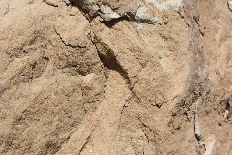
The photographs below are of the area at the base of the Monticello Dam at Devil’s Gate, which were taken by me in July 2006. The first photograph in the top row below shows the type of land that surrounds the dam, and the other photographs are of sandstone rocks found along the road near the dam, including a close-up photograph of the light-brown sandstone. (The sandstone quarry located at Devil’s Gate was owned by E. F. Searles (of San Francisco) and operated by Benoit Bertholet (of Winters) possibly from as early 1882 through the early 1900’s. Sandstone quarried there has been referred to as Putah Gate sandstone, Devil’s Gate sandstone, and Winters sandstone.) Peggy B. Perazzo
 |
 |
 |
 |
The photographs in the top row below are of the Benoit Bertholet building constructed in 1892, which is located at 26 Main Street in Winters. This building was constructed of the light brown sandstone quarried at Devil’s Gate in Putah Canyon by Benoit Bertholet at the location of the Monticello Dam. A darker sandstone from the Winters sandstone quarry was used on the front of the building located at 30 Main Street that shares a wall with the Bertholet building. This darker sandstone more closely matches the description of the sandstone from that quarry, which was described in the old geology books as a “bluish-gray” color.
The first photograph in the second row below is of the side of the B. Bertholet building at 26 Main Street which local volcanic tuff was used, according to a local builder who had worked on the building. This light-colored volcanic tuff was also used on the back of the building located next to the Bertholet building, which was also constructed by Bertholet.
Next to the photograph of the side of the Bertholet building is a photograph of the Michaels building, located on Main Street in Woodland, which was also constructed of Winters sandstone. (Sandstone quarried there has been referred to as Putah Gate sandstone, Devil’s Gate sandstone, and Winters sandstone.)
 |
 |
 |
 |
Below are photographs of sandstone cemetery stones, cemetery stone bases, and curbing constructed from Winters sandstone located at the Winter’s Cemetery. According to Brett Dunham, Winters Cemetery Manager, the Winters sandstone quarried at Devil’s Gate was used in the cemetery for monuments, monument bases, and curbing. I have not checked other Yolo County cemeteries yet to see if the sandstone was used elsewhere. Peggy B. Perazzo
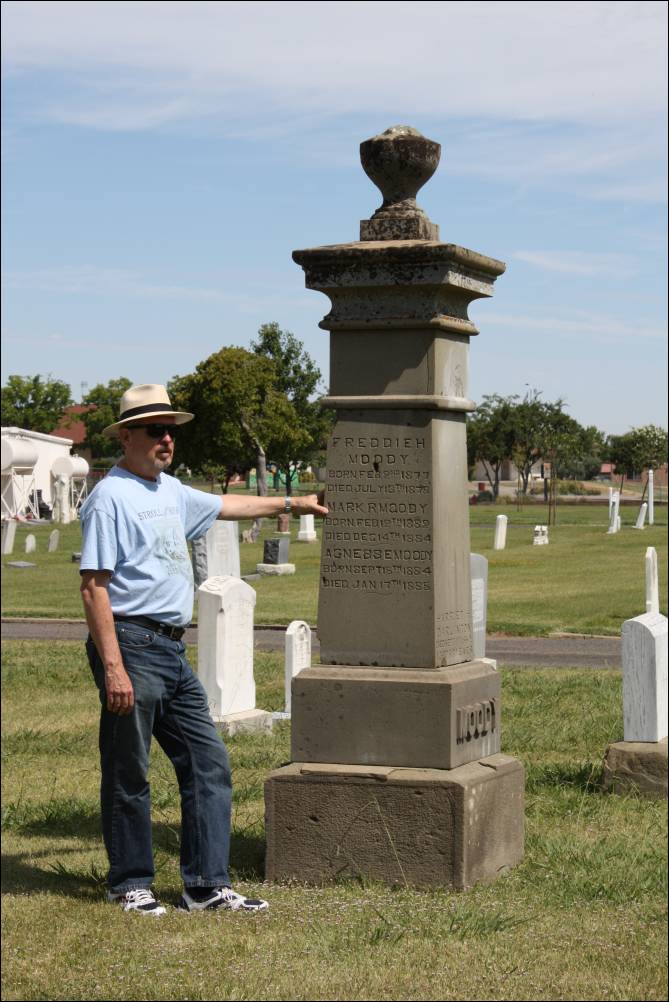
The photographs below are of sandstone monuments and bases located at the Winters Cemetery, Winters, California, created from sandstone quarried at Devil’s Gate at Putah Creek, Yolo County. (David L. Wilkinson, architectural historian and author of Crafting a Valley Jewel: Architects and Builders of Woodland (Yolo County Historical Society, 2003), is shown standing by one of the monuments below.)
The photograph to the right is of the Bertholet family plot in the Winters Cemetery. Benoit Bertholet and family members are buried here. Sandstone, quarried at Devil’s Gate, was used for the stone at the entrance of the family plot, as in other parts of the cemetery. (Benoit Bertholet operated the sandstone quarry at Devil’s Gate.) The following photographs were taken and contributed by David L. Wilkinson, architectural historyian and author of Crafting a Valley Jewel: Architects and Builders of Woodland (Yolo County Historical Society, 2003) and leader of the “Stones of Woodland” tour held at the annual Stroll Through History in Woodland, Yolo County, California, each September. David was accompanied on this trip with his friend Tom Potters. These photographs are of the Yolo County side of Monticello Dam at or near the location of the old Putah Creek / Devil’s Gate / Winters sandstone quarry. In the right-hand photo in the second row below, Tom Potters is displaying the light brown sandstone found in the area. (Sandstone boulders found dumped along Road 128 display colors varying from light brown sandstone - as seen below - to a bluish-gray sandstone that was described in California Bureau of Mining books.)


 |
 |
 |
 |
The photographs below are of sandstone boulders that we found dumped along State Highway 128 between Winters and the Monticello Dam in Yolo County. While the origin of the boulders is not known, the light-colored sandstone boulders appear to be similar to the color of the sandstone used for the cemetery stones, bases, and curbing in the Winters Cemetery and the Benoit Bertholet building in Winters, California. The darker-colored sandstone seen in the boulder in the first row below, right side, appears to be similar to the sandstone used in the building to the right of the Bertholet building on Main Street in Winters and the Michael building located on Main Street in Woodland.
-
Putah Canyon/Devil’s Gate, Winters, Yolo County, California – Benoit Bertholet (1839-1910), Quarrier and Builder in Yolo County during the late 1800s to early 1900s
- Benoit
Bertholet – Obituary dated February 2, 1910
Benoit Bertholet was born in Alsace-Lorraine, France. (Lyon, France, according to his obituary.) He served in Algiers, Morocco, in the Foreign Legion; and then he served in the French Army in Mexico under Maximilian. After he was discharged from the Foreign Legion, he immigrated to New York; Boston, Massachusetts, which is where it appears that he married his wife, Zelia Bertholet. He then moved his family to Chicago, Illinois, and then on to Sacramento, California, where he worked on the stone work at Folsom Prison and the historic California State Capitol. After Sacramento, he moved his family to the San Francisco Bay Area where he worked on Mare Island and spent several years in the Richmond district of San Francisco. By the 1880 federal census, he had moved his family to Alameda, Alameda County; and they later moved to Winters in Yolo County.
Further information on Benoit Bertholet and his family is available in the Biography of his son Alfonse John Bertholet (below) and the PDF document that includes the newspaper articles contributed by Jeannie Miyama (also below). A photograph of Prosper Bertholet is included in Winters: A Heritage of Horticulture, A Harmony of Purpose, by Joann Leach Larkey, pp. 42. “One of the all-time great Winters baseball teams photographed in 1898…” (Yolo County Historical Society, Woodland, CA, 1991)
Benoit Bertholet quarried sandstone at Devil’s Gate and possibly operated quarry locations. He constructed buildings in both Winters and Woodland.* (According to a local Winters builder, volcanic tuff was used on the back of the Benoit Bertholet building that Bertholet constructed on Main Street in Winters.) According to the biography of his son, Alfonse John Bertholet, Benoit Bertholet “…furnished six carloads of stone for the Memorial Arch** at Stanford University (constructed in 1899) and the Stewart Mausoleum in Suisun***….” One the buildings that Bertholet constructed of the sandstone he quarried at Devil’s Gate was the Michael building on Main Street in Woodland. The Michael building is one of the historic buildings that is highlighted on David Wilkinson’s “Stones of Woodland” tour held during the Stroll Through History every September.
- Benoit
Bertholet – Obituary dated February 2, 1910
- Biography of Alfonse John Bertholet, son of Benoit Bertholet, from History of Yolo County, Its Resources and Its People, William O. Russell, editor, Woodland, California, 1940, pp. 492-493.
- Newspaper articles relating to Benoit Bertholet, his wife Zelia, his children and his grandchildren, contributed by Jeannie Miyama, Research Volunteer (in PDF format). (Children: Prosper S. Bertholet; Angiel (aka Angel) H. Bertholet; Hazel Zoe (Bertholet) Nehring; and Alphonse/Alfonse Bertholet), (Grandchildren: Ben Nehring & Angiel (Nehring) Sirard)
- If you have information, photographs, or records that you would like to contribute relating to Benoit Bertholet, his quarrying and building operations, or his family, you are welcome to send them on to me for inclusion in this section. Peggy B. Perazzo.
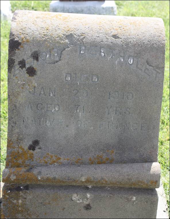
- Below are photographs of the Bertholet family plot and sandstone cemetery stone of Benoit Bertholet constructed from Winters sandstone quarried at Devil’s Gate. As you can see, the Bertholet’s sandstone monunent is splitting along the back side. (Winters Cemetery, Winters, California)
- Putah Canyon, Yolo
County, California – Putah
Creek Sandstone Quarry
See: “Devil’s Gate, Putah Canyon, Yolo County, California – Putah Creek Quarry” above.
- Putah Canyon, Yolo County, California - Millstone Quarry (from Winters:
A Heritage of Horticulture, A Harmony of Purpose, by
Joann Leach Larkey, Yolo County Historical Society, Woodland,
Ca, 1991, pp. 21)
In the “Stone and Water Resources of Putah Canyon” section of the above-cited book, the author indicates that millstones quarried in Putah Canyon were used for some of the first grain mills in Napa and the Sacramento Valley. The two names listed in relation to quarrying the millstones are William Baldridge and Thomas Bradley. Baldridge and Bradley retrieved a millstone cut by William Baldridge in June 1846.
- Putah Canyon (upper), Yolo
County, California – Millstone
Quarries circa 1846 - Excerpt from Historic
Spots of California, by Mildred Brooke Hoover, Douglas
E. Kyle, 4th ed., 1990, “Yolo County,” pp.
437.
Winters
“…Stone quarries in the upper (Putah) canyon furnished grinding stones for some of the first gristmills in northern California as early as 1846. Later, stone for many private and public buildings was extracted from the Bertholet Quarry, Devil’s Gate, a jagged rock outcropping at the head of Putah Canyon where Yolo, Napa, and Solano counties meet, became the site of Monticello Dam….”
- Putah Canyon (upper), Yolo
County, California – Millstone
Quarries circa 1846 - Excerpt from Historic
Spots of California, by Mildred Brooke Hoover, Douglas
E. Kyle, 4th ed., 1990, “Yolo County,” pp.
437.
- Winters (south of) in Yolo County & 8 miles
north of Vacaville in Solano County, California - E.
Gordon Ranch Sandstone Deposit (Sandstone) - Excerpt
from Tenth Annual Report of the State Mineralogist, For the
Year Ending December 1, 1890, California State Mining Bureau,
Sacramento: State Printing 1890, pp. 773-794. (This book is available
for reading or downloading to your computer on Google
Book Search - Full View Books.)
Yolo County - Building Stone, by W. L. Watts, Assistant in the Field.
“A sandstone suitable for building purposes is also said to occur on the ranch of E. Gordon, about eight miles north of the Vacaville and Clear Lake Railroad.”
- Winters (west of), Yolo County, California – Volcanic
Tuff Deposit (Volcanic Tuff) (circa 1890) - Excerpt from Tenth
Annual Report of the State Mineralogist, For the Year Ending December
1, 1890, California State Mining Bureau, Sacramento: State
Printing 1890, pp. 773-794. (This book is available for reading
or downloading to your computer on Google
Book Search - Full View Books.)
Yolo County - Building Stone, by W. L. Watts, Assistant in the Field.
“...A volcanic tuff occurs abundantly in the eastern margin of the foothills to the west of Winters, and in places affords a fair building material. It is a soft, whitish rock, which becomes hard on exposure to the air.
“The residence of J.R. Wolfskill was built of this stone about twenty-five year ago, and appears to stand the weather remarkably well; several other building in winters are built of similar material.”
- Winters (west of), Yolo County, California – Volcanic
Tuff Deposit (circa 1896) (Volcanic Tuf) – Excerpt
from “Mines
and Mineral Resources of Yolo County,” by J. C. O’Brien,
District Mining Engineer, California State Division
of Mines, in California Journal of Mines and Geology, Vol.
46, No. 3, July 1950, State of California Department of
Natural Resources, Division of Mines, pp. 421-436.
“A volcanic tuff deposit occurs in the foothills west of Winters. Selected material was used to build houses in Winters many years ago. It is a soft whitish rock which becomes hard on exposure to the air and appears to weather remarkably well.”
- Winters (west of), Yolo County, California – Volcanic
Tuff Deposit (circa 1896) (Volcanic Tuf) – Excerpt
from “Mines
and Mineral Resources of Yolo County,” by J. C. O’Brien,
District Mining Engineer, California State Division
of Mines, in California Journal of Mines and Geology, Vol.
46, No. 3, July 1950, State of California Department of
Natural Resources, Division of Mines, pp. 421-436.
- Winters (west of), Yolo County, California – Volcanic
Tuff west of the town of Winters (The
following information is from the Yolo
County General Plan Summary, no dated
listed, pp. 116. The link from which the following information was obtained is no longer available.)
Building Stone
“A bluish-gray sandstone was quarried in the Devil’s Gate area on Putah Creek, about nine miles west of Winters from 1894 to 1908. The stone was used for monuments and as a building stone for many years. A volcanic tuff occurring in a very small deposit in the foothills west of Winters was also used as a building stone in the early development of Yolo County. It is a soft, whitish rock which becomes hard on exposure to the air and appears to weather remarkably well.”
- Winters (west of), Yolo County, California – Volcanic
Tuff Deposit (Volcanic Tuff) (circa 1890) - Excerpt from Tenth
Annual Report of the State Mineralogist, For the Year Ending December
1, 1890, California State Mining Bureau, Sacramento: State
Printing 1890, pp. 773-794. (This book is available for reading
or downloading to your computer on Google
Book Search - Full View Books.)
- Winters (west of), Yolo County, California – Sackett
Quarry (Volcanic Tuff) (Excerpt from Report
XIV of the State Mineralogist – Mines and Mineral Resources
of Portions of California, Chapters of State Mineralogist’s
Report – Biennial Period 1913-1914,
Part II. “The Counties of Colusa, Glenn, Lake, Marin,
Napa, Solano, Sonoma, Yolo,” by
Walter W. Bradley, Field Assistant (field work in September,
1913), California State Mining Bureau, San Francisco, California,
1916, pp. 173-370.)
“Sackett Quarry. Sackett Bros. owners. On the Sackett ranch, 5 miles west of Winters, there is a body of light-colored volcanic tuff which has been utilized locally for building purposes, but not recently.
“Bibl.: R. X., p. 791; XIII, p. 640; Bull. 38, p. 164.”
- Winters (7 miles from), Yolo County, California - Sandstone
Quarry (Sandstone) (circa 1890) - Excerpts from Tenth
Annual Report of the State Mineralogist, For the Year Ending December
1, 1890, California State Mining Bureau, Sacramento: State
Printing 1890, pp. 773-794. (This book is available for reading
or downloading to your computer on Google
Book Search - Full View Books.)
Yolo County, by W. A. Goodyear, Geologist, and Assistant in the Field.
“In the mountains about seven miles up the creek from Winters there is on the left bank of the creek a quarry of yellowish brown sandstone, moderately hard, with pretty uniform and rather fine grain, which has been used to some extent for building purposes and for fence posts and monuments in the cemetery. At the quarry it strikes about north 30 degrees west magnetic and dips about 70 degrees northeast, and is very heavy bedded. It can be obtained in very large blocks, if desired, and its quantity is inexhaustible....”
- Winters (9 miles from), Putah Canyon, Yolo
County, California – Winters
Sandstone Quarry
See: “Devil’s Gate, Putah Canyon, Yolo County, California – Putah Creek Quarry” above.
- Winters (9 miles from), Putah Canyon, Yolo
County, California – Winters
Sandstone Quarry
 |
 |
 |
 |
(* Photographs of some of the buildings he constructed can be found in the sections above on the Devil’s Gate / Putah Creek / Winters sandstone quarry sections.)
(** You can view photographs of the Memorial Arch at Stanford University at Stanford University Centennial Commemoration – Memorial Arch. Bertholet may only have supplied a portion of the sandstone for the Memorial Arch as other accounts note that the sandstone came from the Graystone Quarry in San Jose, Santa Clara County.)
(*** If anyone has information on the “Stewart Mausoleum in Suisun,” I would like to hear from you so I can locate and photograph the mausoleum. Peggy B. Perazzo)
 |
 |
 |
 |
 |
 |
Commercial use of material within this site is strictly prohibited. It is not to be captured, reworked, and placed inside another web site ©. All rights reserved. Peggy B. and George (Pat) Perazzo.