
Excerpts From
Construction Materials in Ellis
County, Kansas
Geological Survey Circular 30
By Frank E. Byrne, Vincent B. Coombs,
and Charles H. Bearman
Prepared in Cooperation with State Highway Commission of
Kansas
Department of the Interior for Development, Geological
Survey
Washington, D. C., April, 1949
Purpose of the Investigation
The State Highway Commission of Kansas and the United States Geological Survey are cooperating in the compilation of a State-wide inventory of construction materials. In the summer of 1946, the U. S. Geological Survey sent a field party into Ellis County, Kans., to investigate sources of such materials. This report of the Ellis County investigation is a part of the general inventory and a contribution to the geologic mapping and investigation of mineral resources being made in connection with studies of the Missouri River Basin.1
-
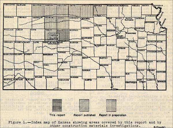
Figure 1. Index map of Kansas showing areas covered by this report and by other construction materials investigations.

Area covered by the investigation
Ellis County is in the third tier of counties south of the Kansas-Nebraska border and in the fifth tier east of the Colorado border. (See fig. 1.) Its area is about 9900 square miles, and it comprises 25 townships. The county is bounded by parallels 38° 39' and 39° 08' north latitude and meridians 98° 58' and 99° 38' west longitude. Ellis County is bordered on the east by Russell County, on the west by Trego County, on the north by Rooks County, and on the south by Rush County.
Geography of the Area
Ellis County is in the border region of the Great Plains physiographic province. Streams cutting headward from the Central Lowlands province to the east have dissected the border region to one of low to moderate relief. The streams occupy steep-sided valleys, many of which are out more than 100 feet below the gently rounded upland surface. The areas of greatest relief in Ellis County are along the Saline River in the northern part of the county, along Big Creek in the western part of the county, and along the Smoky Hill River in the southern part of the county..
Ellis County is served by one railway, the main line through Kansas of the Union Pacific Railroad. The principal cities, Hays (the county seat and largest city), Ellis, and Victoria, are located along this railroad.
There is a well-developed system of highways and county roads. The Federal highways are of the blacktop type of construction. U. S. 40, a major east-west transcontinental route parallels the Union Pacific Railroad, and U. S. 183, an important north-south highway, extends through the center of the county. Most of the roads maintained by the county follow section lines. Many of them are metalled, and most of the others are maintained by grading.
-
Figure 3. Outcropping stratigraphic units in Ellis County, Kansas, and their construction materials.


Inventory of Construction
Materials
(Note: Only the section on "Structural Stone" will be included
here.)
Structural Stone
Engineering and Geologic Characteristics:
Structural stone, as defined in this report, is any hard, uniform-textured rock material that can be quarried and cut to desired size and form. The sources of this material in Ellis County are somewhat deficient in one respect or another, as indicated in the descriptions that follow:
Stratigraphic Sources and Performance Characteristics
(1) Greenhorn Limestones: The "Fencepost" limestone bed at the top of the Pfeifer shale member is used extensively as structural stone throughout the area of its outcrop. Many barns, houses, stores, and other business buildings have been constructed of this rock. Use of the "Fencepost" limestone as structural stone in the construction of small bridges was observed in the southeastern part of Ellis County. Field observation indicates that this material is satisfactory for the uses listed above. The stone apparently has relatively high bearing strength and is not adversely affected by weathering. The rock is easily quarried and casehardens after exposure to air. The chalky character of the limestone, however, indicates that it would not be advisable to use the stone in places where it would come in long-continued contact with water. It is probable that in such situations the material would deteriorate through slaking or by freeze-and-thaw.
(2) Fort Hays Limestone member of Niobrara formation: The Fort Hays limestone member has been used in the northern part of the county as a structural stone for dwellings and farm buildings. The stone hardens after being cut, and structures built of it stand up well in the relatively dry climate of western Kansas. Field observations indicate that the Fort Hays limestone should not be used in a place where it is subject to water saturation, such as in the foundations of buildings. In such places the stone deteriorates fairly rapidly by freeze-and-thaw or slaking or through both processes.
1 Construction Materials in Ellis County, Kansas, 1951, page 1, footnote 1: Missouri River Basin, conservation control, and use of water resources: 78th Cong., 2d sess., S. doc. 191, 1944.
Commercial use of material within this site is strictly prohibited. It is not to be captured, reworked, and placed inside another web site ©. All rights reserved. Peggy B. and George (Pat) Perazzo.