
Home > Search > Site Map > Georgia > List of Quarries in Georgia
& Quarry Links, Photographs and Articles
List of Quarries in Georgia & Quarry Links,
Photographs and Articles
- Taylor Ridge, Chattooga
County, Georgia – the
Peters Property – Rockwood Shales (Shales), from A
Report on the Limestones and Cement Materials of North
Georgia, Bulletin No. 27, by T. Poole Maynard, Ph.D., Assistant
State Geologist, Geological Survey of Georgia, 1912, pp. 252.
Plate XX. A. Red iron ore on the Rockwood shales, Peters Property, Taylor Ridge, Chattooga County, Georgia. 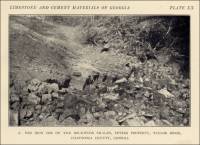
- Tivola (south of), Houston County, Georgia – Old Limestone
Quarry on G.S. & F. Right-of-way (Limestone) (from A Report
on the Limestones and Marls of the Coastal Plain of Georgia,
Bulletin 21, 1910, by J. E. Brantly, Assistant State Geologist, Geological
Survey of Georgia, Atlanta, GA: The Blosser Co., 1916, pp. 48)
Plate III. B. Old limestone quarry on G.S. & F. right-of-way, south of Tivola, Houston County. 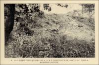
- Wilkes County, Georgia – the Star Granite Co. Granite
Quarry (Granite).
In 1995 this company was operating a granite quarry in Wilkes County. At that time the company headquarters was in Elberton, Georgia. (From United States Geological Survey, “Mineral Industries Surveys – Directory of Principal Dimension Stone Producers in the United States in 1995,” prepared in January 1997.)
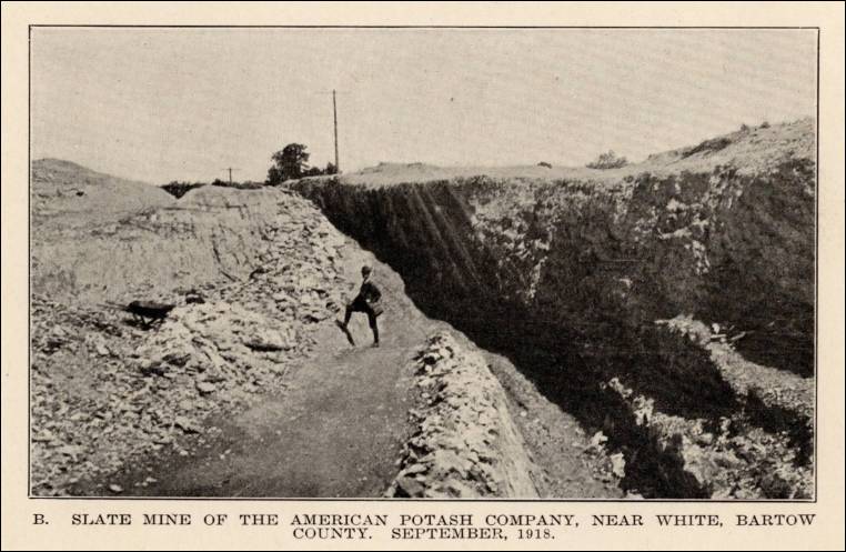
- White (near), Bartow County, Georgia – the American
Potash Company Slate Mine (Slate), from Report on The
Slate Deposits of Georgia, Bulletin No. 34, by H. K. Shearer,
Assistant State Geologist, Geological Survey of Georgia, 1918, pp.
160.
Plate XI. B. Slate mine of the American Potash Company, near White, Bartow County, September, 1918. 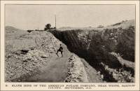
- White (north of), Bartow County, Georgia – Green Slate
Exposure (Slate), from Report on The Slate Deposits
of Georgia, Bulletin No. 34, by H. K. Shearer, Assistant State
Geologist, Geological Survey of Georgia, 1918.
Plate VIII. B. Exposure of green slate in the Louisville & Nashville Railroad cut near the Cartersville Poor Farm, one mile north of White, Bartow County. (pp. 120) 
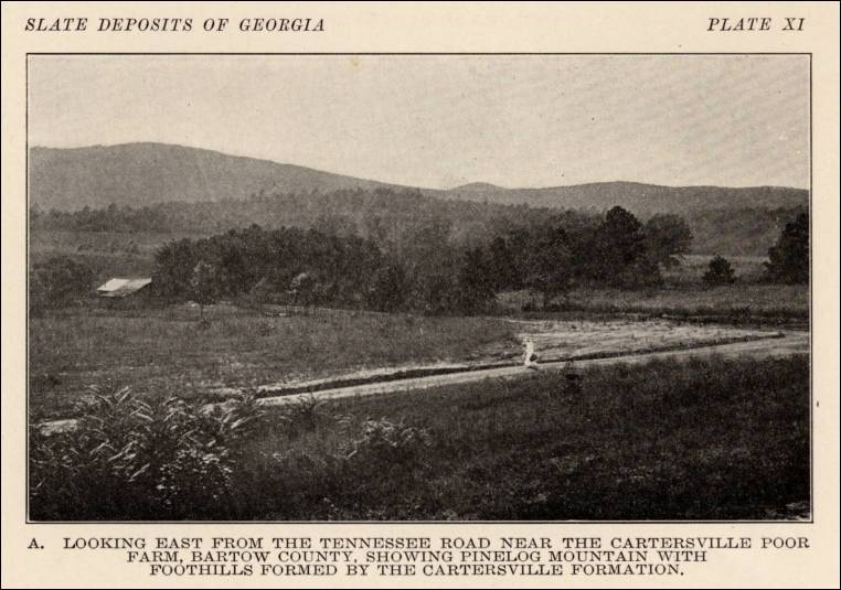
Plate XI. A. Looking east from the Tennessee Road near the Cartersville Poor Farm, Bartow County, showing Pinelog Mountain with foothills formed by the Cartersville Formation. (pp. 160) 
- Whitfield County, Georgia – the American Black Marble
Company Marble Quarry (Marble), from A Report on the
Limestones and Cement Materials of North Georgia, Bulletin No.
27, by T. Poole Maynard, Ph.D., Assistant State Geologist, Geological
Survey of Georgia, 1912, pp. 88.
Plate V. A view showing outcrop of black marble at the quarry of the American Black Marble Company, Whitfield County, Georgia. 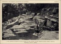
- Whitestone, Georgia – the Detroit Marble Company – Murphy
Marble (Marble), from A Report on the Limestones and
Cement Materials of North Georgia, Bulletin No. 27, by T. Poole
Maynard, Ph.D., Assistant State Geologist, Geological Survey of Georgia,
1912, pp. 124.
Plate IX. A. Murphy Marble, Detroit Marble Company, Whitestone, Georgia. 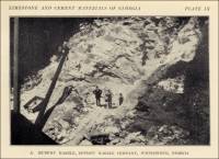
- Whitestone (near), Gilmer County, Georgia – Marble
Bluff near Whitestone (Limestone), from A Report on
the Limestones and Cement Materials of North Georgia, Bulletin
No. 27, by T. Poole Maynard, Ph.D., Assistant State Geologist, Geological
Survey of Georgia, 1912, pp. 64.
Plate III. Marble bluff, near Whitestone, on the Louisville and Nashville Railroad, Gilmer County, Georgia. 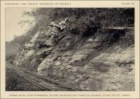
- Whitestone, Georgia – the Whitestone Marble Company
Mill (Marble), from A Report on the Limestones and
Cement Materials of North Georgia, Bulletin No. 27, by T. Poole
Maynard, Ph.D., Assistant State Geologist, Geological Survey of Georgia,
1912, pp. 122.
Plate VIII. B. Mill of the Whitestone Marble Company, Whitestone, Pickens County, Georgia. Quarry located immediately east of the mill. 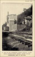


Commercial use of material within this site is strictly prohibited. It is not to be captured, reworked, and placed inside another web site ©. All rights reserved. Peggy B. and George (Pat) Perazzo.