
Siskiyou County
- Siskiyou County – List of Stone Quarries, Etc.
- Siskiyou County Granite, Limestone, Marble, Sandstone, Serpentine, and Soapstone (historical times through circa 1906) – Excerpts from The Structural and Industrial Materials of California, Bulletin No. 38, California, State Mining Bureau, San Francisco, California, 1906.
- Siskiyou County Tuff Resources circa 1913 – Included in chapter in “California,” by G. F. Loughlin, in the Mineral Resources of the United States Calendar Year 1913, Part II. Nonmetals, United States Geological Survey, 1914.
- Siskiyou County Mines and Mineral Resources (circa 1913-1914) – Excerpts from Report XIV of the State Mineralogist – Mines and Mineral Resources of Portions of California, Chapters of State Mineralogist's Report – Biennial Period 1913-1914, Part VI. "The Counties of Shasta, Siskiyou, Trinity," 1916.
- Siskiyou County Mineral Industry (circa 1919) – Excerpt from California Mineral Production for 1919, Bulletin No. 88, by Walter W. Bradley, California State Mining Bureau, 1920.
- Siskiyou County Limestone and Marble Industry and Deposits (through 1947) – Excerpts from “Limestone in California,” by Clarence A. Logan, California Journal of Mines and Geology, Vol. 43, No. 3, July 1947, California Division of Mines, San Francisco, California.
- Siskiyou County Mines and Geology (circa 1947) – Excerpts from “Mines and Mineral Resources of Siskiyou County,” California State Division of Mines, California Journal of Mines and Geology, pp. Vol. 43, No. 4, October 1947
- Siskiyou County Limestone (circa 1949) – Excerpts from "Geology of Limestone near Gazelle, Siskiyou County, California, Journal of Mines and Geology, vol. 45, No. 4, October 1949.
-
Siskiyou County Granite, Limestone, Marble, Sandstone,
Serpentine, and Soapstone (historical times through circa 1906) –
Excerpts from The Structural and Industrial Materials of California,
Bulletin No. 38, California, State Mining Bureau, San Francisco, California,
1906.
Siskiyou County Granitic Rocks:
"There is a great amount of granite and granodiorite in Siskiyou County. The greater portion is, however, too much shattered to be used for monument or building purposes.
"On Craggy Mountain, about in Secs. 22 and 23, T. 41 N., R. 8 W., there is a large body of granite from which blocks of any desired size can be obtained. It is used for building purposes and coping.
"In Scott River cañon, between Fort Jones and Scott's Bar, is a granodiorite, mostly dark colored, sometimes grayish, which is sufficiently massive to be used. It is of very good quality and very easily worked.
"Southeast of Etna, on Mill Creek, about in Sec. 1, T. 41 N., R. 9 W., there is a large body of very fine-grained granite, closely resembling Berry (sic) granite (Vermont), taking a fine polish and used for monument work.
"A similar grade of granite is found southwest of Callahan, in the southwest corner of T. 40 N., R. 8 W., and the southeast corner of T. 40 N., R. 9 W.
"At the head of Park's Creek, in T. 41 N., R. 6 W., another body of gray granite of good quality is found."
Siskiyou County Limestone:
"Limestone is found in Siskiyou County in great abundance, not only in belts of large, disconnected exposures, some of which are very extensive, but also in small patches scattered between other formations, especially the schists. Sometimes it has the laminated structure of the schists to such a degree that a superficial examination of hand specimens does not disclose their mineral character.
"One belt of limestone runs from a little west of Etna in a general northwesterly direction, along the eastern slope of the Salmon Mountains, forming farther north part of the Marble Mountains, and of the Grider Mountains, showing north of the Klamath River on Thompson Creek and running farther north into Oregon. The limestone of this belt is nearly all altered into marble, and is described under that heading. In the other limestone belts of this county the alteration has not been so complete, although marble is found in nearly all the limestone deposits.
"East of Scott River there are a number of separate exposures of limestone, some of which are here mentioned. As, so far as known, no positive data regarding the age of these limestones have been ascertained, it is not possible to state whether they belong to one belt or not."
Siskiyou County Marble:
"A belt of marble runs from a little west of Etna in a general northwesterly direction along the eastern slope of the Salmon Mountains, forming farther north part of the Marble Mountains, and in the Grider Mountains showing north of the Klamath River on Thompson Creek, and running farther north into Oregon."
Siskiyou County Sandstone:
"A very extensive bed of sandstone runs along the east side of the Kildall hills, Black Mountain range, and Cottonwood Mountains, into Oregon. Its southern extremity is about in Sec. 4, T. 44 N., R. 6 W. It is found east of Yreka in two large exposures. The most southern runs from the southern extremity of the belt to Secs. 25 and 26, T. 45 N., R. 7 W., along the eastern rim of the Kildall hills. It forms a narrow ridge, with steep slopes on both sides.
"North of this ridge the sandstone crops out again in sec. 13, T. 45 N., R. 7 W., where it forms another ridge having a northeasterly direction, also forming the rim of the Shasta River Valley.
"The same sandstone crops out a few miles south of Ager, along the east side of Black Mountain range, where a coal mine has been worked in the sandstone at the Herr ranch.
"The same belt shows in the vicinity of Hornbrook in the ridges surrounding the valleyes (sic) of the Klamath River and the lower part of Cottonwood Creek.
"West of Hornbrook and Henley, along the rim of the Cottonwood Mountains, runs a belt of fine-grained gray sandstone, not over a quarter of a mile wide. It forms a landmark, as its surface sloping east forms for a greater portion of the bare lower slope of the mountains, its gray color being distinguishable from a long distance.
"The sandstone is very fine-grained, compact and hard. It consists of small granules of quartz, with some small ones of hornblende, and is known as the Henley sandstone. The relation of this sandstone to that east of the valley is not clear. Whether it underlies the latter or does not persist farther than exposed at the surface has not been determined as yet."
Siskiyou County Serpentine:
"Most of the serpentine found in Siskiyou County has a conchoidal fracture. A belt of it runs along a part of the main ridge of the Cottonwood Mountains, forming there 'Shafts Rock,' a prominent landmark at the head of Bogus and Dutch creeks. Samples show that it takes a fine polish, and breaks so as to form blocks which can be used as structural material."
Siskiyou County Soapstone:
"Soapstone is found in several places in Siskiyou County.
"A large belt of soapstone is reported from south of Marble Mountain, near the head of Wolley Creek, in the northeast part of T. 13 N., R. 8 E., H. M.
"A large exposure of soapstone is found in the northeast sections of T. 45 N., R. 11 W., southeast of Hamburg Bar, having a course of No. 50 E. It can be traced toward the ridge west of Scott River. On the divide it is from 40 to 50 feet wide. The soapstone is of very good quality, and resists the effect of fire for years in fireplaces without any deterioration, resembling pressed firebrick. It is also used in sheets one half to three quarters of an inch thick for stovebacks."
- Siskiyou County Mines and Mineral Resources (circa 1913-1914) –
Excerpts from Report XIV of the State Mineralogist - Mines and Mineral
Resources of Portions of California, Chapters of State Mineralogist's Report
- Biennial Period 1913-1914, Part VI. "The Counties of Shasta,
Siskiyou, Trinity," by G. Chester Brown, Field Assistant (field work
in September, 1913), San Francisco, California, July, 1915, California State
Mining Bureau, San Francisco, California, 1916, pp. 746-925.
Introduction (to Siskiyou County)
"Siskiyou County, with an area of 3040 square miles, lies along the northern boundary of California, and has Del Norte adjoining it on the west, Modoc on the east and Shasta and Trinity counties on the south. It has an exceedingly broken and picturesque expanse of mountains, and canyons cut by many streams running westerly to the Klamath River and southward to the Sacramento River, the former stream coursing through the county for 70 miles.
"The most prominent mountain ranges are the Klamath, Scott and Salmon. Mount Shasta, in the southern part, having an elevation of 14,380 feet, is a noted landmark. The Sierra Nevada lava sheet covers a portion of the eastern part of the county, forbidding both mining and agriculture.
"The mineral wealth, which constitutes the basis of Siskiyou's prosperity, is concentrated in various belts and districts. There are two main agricultural sections, the Scott and Shasta valleys, which afford supplies for the surrounding country.
"Although the day of simple placer mining has passed, the auriferous gravels still provide the bulk of the county's gold output. Gold dredging is being successfully pursued on McAdams Creek, near Fort Jones; and as there are many acres of gravel that will yield handsome returns by this method of mining, dredging bids fair to become one of the important industries of the county.
"Hydraulic mining has been extensively pursued along the Klamath River and important tributaries, and large areas of pay gravel still remain to be worked (circa 1913). The old method of river mining by means of wing-dams has practically passed out of existence.
"Quartz mining, which really gives stability to the industry, has made wonderful strides in Siskiyou County during the past ten years, in spite of the lack of transportation facilities, especially railroads. The Oregon branch of the Southern Pacific Railroad, which crosses the county, connects at Montague with the Yreka railroad, thus affording a rail connection for Yreka, the county seat. Wagon roads to the remote mining districts are being constructed as rapidly as the funds of the county will permit.
"The unusual strikes of 'high grade' ore in the Salmon range, especially in the Homestake and Highland mines, has stimulated lode mining and given the county the publicity it deserves. The Black Bear, with a production record of over $2,500,000, is the most noted gold quartz producer in Siskiyou County. There are many prospects that should develop into producers with the expenditure of a moderate amount of money. The conditions for mining are ideal, due to the abundance of both water and timber, and the California-Oregon Power Company affords cheap electrical power to many of the mining sections.
"The minerals found within the borders of this county are many and widely distributed, among which may be enumerated, gold, platinum, silver, lead, chrome, copper, and coal. There are several mineral springs also, the most famous being the Shasta, on the line of the Oregon branch of the Southern Pacific Railroad.
Geological and Topographical Features (of Siskiyou County)
"The formation and metalliferous belts of Siskiyou County are not so clearly defined as in the middle counties of the State; the Coast and Sierra Nevada ranges are here merged into one. The strike of the stratification has been changed from west of north to north 20 east.
"In the Klamath, Salmon and Scott ranges, the mountains are rough and sharply defined, and table lands are seldom seen, as sharp serrated ridges have replaced them, with deep gorges and precipitous canyons.
"Though the mountains of the western half belong to the Coast Range system, their general geological character is that of the Sierras, as granites, diorites and metamorphic slates and limestones, similar to the latter mountain system, comprise their mass. Between these western mountain systems and the lava beds, which cover a large area, including much of the drainage area of the Shasta and Little Shasta rivers and Cottonwood Creek, is a section, the characteristic rock of which is a fossiliferous sandstone. In the Shasta and Willow Creek valleys coal seams are found, stratified with the sandstone; these seams of lignite (coal) of good quality, vary from a few inches to four feet in width and rest on a quartzite substratum, which formed the rim rock of the basin.
"Following the quartzite in a westerly direction for about 1 mile, a belt of magnesian rocks containing iron is observed, which continues for some 2 miles, when the main gold-bearing belt of the region is encountered.
Description of Streams (in Siskiyou County)
Klamath River.
"This river and its tributaries have been important agents in the distribution of placer gold throughout the country (see photo No. 1). Its source is in the mountain ranges of northern California and southern Oregon, drawing from the Upper and Lower Klamath, Goose and Rhett lakes, and flowing southwesterly into the Pacific Ocean at a point forming the western extremity of the dividing line between Del Norte and Humboldt counties. The length of the Klamath is some 362 miles, the average grade being 12 feet to the mile, 70 miles of which is in Siskiyou County.
Photo No. 1. Klamath River near Happy Camp. 
Gold is found wherever the river has deposited gravel, whether it be in an old channel a thousand feet above the present stream, or in the river bottom. Below the mouth of Scott River it has cut its way through the northern end of the Coast Range practically at right angles to its trend, and runs through a narrow canyon from a few hundred to several thousand feet in depth, with banks as steep as the material will stand and which are covered with a dense growth of timber and brush. At Oak Bar, Happy Camp, Hamburg Bar, Orleans Bar and a few other points, the mountains recede far enough from the stream to admit of a few acres of level land being farmed; the rest of the country is too steep for cultivation.
"Bibl.: Report VIII, pp. 582, 584, 585.
Scott River. (in Siskiyou County)
"Scott River, one of the important tributaries of the Klamath, enters this stream in Sec. 6 T., 45 N., R. 10 W., M.D.M., at an elevation of 1650 feet above sea level. It has a length of 61 miles, an average course of 20 to the northwest, and is fed by a watershed area of 812 square miles, with 26 miles of tributaries. This stream flows through the mineral districts of Oro Fino, Quartz Valley, Callahan and Scott Bar. In the vicinity of Callahan, on the headwaters of this stream and especially on the South Fork, rich deposits of gravel are found, which have been mined for many years. Below Callahan the river runs through a portion of Scott Valley, a rich and fertile plateau, which is successfully cultivated, and in which are situated the flourishing towns of Etan and Fort Jones. The lower end of the river, for about 4 miles above its mouth, runs through a canyon, and here gold is found in the benches on the hillsides and in bars in the river. Scott Bar, in the center of this district and 2 miles from the mouth of Scott River, is the village from which supplies are distributed to the adjacent territory.
"Bibl.; Report VIII, pp. 593, 594, 605, 606.
Indian Creek. (in Siskiyou County)
"Indian Creek, a tributary to the Klamath River, rises in the lofty snow-clad peaks of the Siskiyou Mountain Range, near the boundary line between California and Oregon. It has a length of 16 miles, flows in a southeasterly direction, and its tributaries, east and west, embrace 14 miles; its watershed area covers144 square miles. Placer deposits are found along the entire length of Indian Creek. Happy Camp, a village on the west bank of the Klamath River at the junction of the Klamath and Indian Creek, is the distributing point for the country generally between Hamburg and Orleans Bar.
"Bibl.: Report VIII, p. 599.
Beaver Creek. (in Siskiyou County)
"This stream, a tributary to the Klamath River, rises in the Siskiyou Mountain Range, near Mount Sterling. It has a length of 12 miles, a general southwesterly course and is fed by the north and south forks of Hungary Creek, Bumble Bee, West Fork of Beaver and other smaller creeks. Placer mining has been pursued along these creeks for the past forty years, and although worked in a crude way considerable gold has been produced. The formations consist of granite, serpentine, slate and porphyrite-schist, cut by gold-bearing quartz ledges and porphyry dikes, which have fed these watercourses for ages.
"Bibl.: Report VIII, p. 591.
Humbug Creek. (in Siskiyou County)
"This creek, is a tributary to the Klamath River, rises in the Humbug Mountains and flows in a northeasterly direction. It has a length of some 10 miles and has been a noted producer of placer gold. Near its source the banks of this stream are steep, the water being confined in a well defined canyon, of heavy grade, but as it approaches the river it widens out, forming large bars, which have been extensively mined. One claim of less than 7 acres has been constantly worked for the last thirty-five years, the output to date exceeding $260,000. Other creeks in this section tributary to the Klamath and which have been noted placer producers are Little Humbug and Barkhouse. From the head of Little Humbug over $2,000,000 was extracted by ground sluicing, and there is still considerable virgin ground to be worked, especially near its mouth, but there is only sufficient water in this creek to allow a two or three months' run each year. Barkhouse, the next creek below Little Humbug, has also been a noted producer, but mining operations are limited on account of the scarcity of water.
"Bibl.: Report VIII, p. 591."

Page1
Page 2Mineral Production of Siskiyou County from 1894 to 1913 (incl.) from
Records of State Mining Bureau.Granite (in Siskiyou County)
"The greater portion of the granite in Siskiyou County is too much shattered to be used for monument or building purposes. There is a large body of granite, however, on Craggy Mountain, T. 41 N., R. 8 W., from which some good building blocks have been obtained. Another deposit, southeast of Etna on Mill Creek in Sec. 1, T. 41 N., R. 9 W., contains some fine-grained stone that has been used for monument work. A similar grade of granite is found in the southwest and southeast corners of T. 40 N., R. 8 and 9 W."
"Bibl.: Bull. No. 38, p. 54.
Limestone (in Siskiyou County)
"Two limestone deposits, one northeast of Greenview and the other southwest of Callahan, have been worked and the material has been converted into lime.
"Bibl.: Bull. No. 38, pp. 92-93."
Macadam (in Siskiyou County)
Steel Quarry, in Sec. 27, T. 45 N., R. 7 W., ¾ mile southeast of Yreka. Owned by J. M. Steel; comprises 100 acres, located in 1896; deposit just being opened up (circa 1913) and its extent not determined as yet; plant consists of a crusher, operated by gasoline, cars, and mining tools; five men are employed; rock used on streets in Yreka."
Marble (in Siskiyou County)
"A belt of marble runs from a short distance west of Etna Mills, in a northwest direction along the eastern slope of the Salmon Mountains, forming, farther north, part of the Marble Mountains, and in the Grider Mountains showing north of the Klamath River on Thompson Creek, and running farther north into Oregon.
"Bibl.: Report XIII, p. 632; Bull. 38, pp. 107-108."
Ornamental Stones (in Siskiyou County)
"Vesuvianite is found on the South Fork of Indian Creek, 12 miles north of Happy Camp, on land owned by Dr. A. E. Heighway; discovered in 1901; outcrops for 300 feet along the hillside, above the creek, and large masses have fallen into the bed of the creek below. It is a hard and handsome stone, olive to green in color, and takes a fine polish. The associated rock is serpentine; the rich translucent green color, fine-grained sub-splintery fracture and brilliant luster, when polished, strongly suggest jade, and many have called it by that name; deposit has not been worked. This variety of vesuviante is also known as californite. F. H. Dakin of San Francisco also has claims covering portions of the deposit."
Sandstone (in Siskiyou County)
"A very extensive bed of sandstone runs along the east side of the Kildal Hills, Black Mountain Range, and Cottonwood Mountains, into Oregon; also found east of Yreka in two large exposures. It forms the rim of the Shasta Valley, having a northeast direction in Sec. 13, T. 45 N., R. 7 W., and also crops out a few miles south of Ager on the Herr ranch, where coal is found. Same belt exposed in the vicinity of Hornbrook in the ridges surrounding the valleys of the Klamath River and the lower part of the Cottonwood Creek. A belt of fine-grained sandstone about ¼ mile in width west of Hornbrook along the rim of Cottonwood Creek forms a landmark, as its surface sloping east comprises the bare lower slope of the mountains, its gray color being distinguishable from a long distance; it is very fine grained, compact and hard, consisting of small granules of quartz, intermixed with some small ones of hornblende.
"Bibl.: Bull. 38, pp. 139-140.
Soapstone (in Siskiyou County)
"Talc is a hydrous silicate of magnesia (4 MgO, 5 SiO2, H2O) that occurs in different varieties, of which soapstone is one of the most important.
"Soapstone is more compact and harder than talc and is used in the manufacture of many articles, such as bath and laundry tubs, switchboards for electrical plants, sinks, griddles and many other articles.
"Talc is used as a powder, or flour talc, and as pieces sawed into various sizes and shapes. The flour talc is used in fireproof paints, electric insulators, boiler and steam pipe coverings, toilet powder, in the manufacture of powder and other articles.
Soapstone is found in several places in Siskiyou County, a large exposure being noted in the northeast sections of T. 45 N., R. 11 W., southeast of Hamburg Bar, having a course of N. 50 E. and can be traced toward the ridge west of Scott River and is 50 feet wide; it is of good quality and resists the effect of fire for years in fireplaces; also used in sheets ½ to ¾ of an inch thick for stove backs. There is another large belt south of Marble Mountain, in T. 13 N., R. 8 E., H. M., near the head of Wolley Creek.
"Bibl.: Bull. No. 38, p. 352.
Talc is found in the Cottonwood Mountains, 30 feet wide, on the top of the divide between Beaver and Bumblebee creeks; it has no grit and the iron content gives it as a light ochreous color; located by E. Caldwell of Hamburg Bar. A small exposure is found near Etna, in Sec. 32, T. 42 N., R. 9 W. Owned by J. Conners; it occurs in a serpentine belt and has no grit.
"Bibl.: Bull. No. 38, p. 353."
- Siskiyou County Mineral Industry (circa 1919) – Excerpt from
California Mineral Production for 1919, Bulletin No. 88, by Walter
W. Bradley, California State Mining Bureau, 1920, pp. 166-167.
Area: 6,256 square miles.
Population: 18,545 (1920 census)
Location: Extreme north-central portion of state, next to Oregon boundary."Siskiyou, fifth county in California in regard to size, located in a highly mineralized and mountainous country, ranks twenty-fourth in regard to the value of its mineral output for 1919. The advance in rank from thirty-ninth in 1917, was due to chromite, notwithstanding the losses in copper, gold and miscellaneous stone. The decrease in 1919 was due mainly to stoppage of chromite mining. Although the county is traversed by a transcontinental railroad in a north and south line, the mineral-bearing sections are almost without exception far from transportation and other facilities. A large part of the county is accessible by trail alone. Future development and exploitation will doubtless increase the productiveness of this part of the state to a great degree.
"Mount Shasta is located in Siskiyou County.
"Among Siskiyou's mineral resources are: Chromite, clay, coal, copper, gems, gold, lead, limestone, manganese, marble, mineral water, pumice, quicksilver, sandstone, silver, and miscellaneous stone.
"Commercial production for 1919 was as follows:
(Headings for the information below are: Substance, Amount, and Value.)
Chromite, 510 tons, $13,379.
Gold, ---, $350,000 (estimated)
Mineral water, 451,500 gals., $90,375
Platinum, 7 oz., $1,015
Silver, ---, $16,000 (estimated)
Stone, miscellaneous, ---, $26,405
Other minerals,* ---, $111,294
(Total value) $608,468(* Includes copper, limestone, pumice, and quicksilver.)
Siskiyou County, 1916 Map, from California Mineral Production for 1919 (with County Maps), Bulletin No. 88, by Walter W. Bradley, California State Mining Bureau, San Francisco: California State Printing Office, 1920, pp. 181. 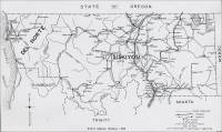
- Siskiyou County Mines and Geology (circa 1947) – Excerpts
from "Mines and Mineral Resources of Siskiyou County," California
State Division of Mines, California Journal of Mines and Geology,
pp. Vol. 43, No. 4, October 1947, pp. 412-461. (Used with permission, California
Department of Conservation, California Geological Survey.)
Mines and Mineral Resources of Siskiyou County, by J. C. O'Brien, District Mining Engineer, California State Division of Mines. Manuscript submitted for publication June 30, 1947.
Introduction
Geography (of Siskiyou County)
"Siskiyou County is one of the three northernmost counties of California. It borders on the state of Oregon for some 110 miles and is bounded on the west by Del Norte and Humboldt Counties, on the east by Modoc County, and on the south by Shasta and trinity Counties. It is from 60 to 70 miles wide and has an area of 4,040,320 acres, of which is from 60 to 70 miles wide and has an area of 4,040,320 acres, of which about 68 percent is in the public domain. The Klamath National forest has an area of 1,291,619 acres; Shasta National Forest, 712,168 acres; and Modoc National forest 92,419 acres, within the county.
"Siskiyou County had a population of 28,598 according to the 1940 census. Yreka, the county seat, is located on U. S. Highway 99 about the center of the county. A branch line about 7 miles long connects it with the mainline of the Southern Pacific Railway at Montague."
Topography (of Siskiyou County)
"The region is mountainous throughout the western half of its area but several valleys in the central and east-central sections include about one-fifth of the total area, and farming ranks second to lumbering as a basic industry…."
Transportation (in Siskiyou County)
"The main line of the Southern Pacific Railway crosses the central part of Siskiyou County from north to south, and there are a few short feeder lines to the east. U. S. Highway 99 follows along the railroad for most of its length across the county. U. S. Highway 97 leaves Highway 99 at Weed and runs northeastward through the county to Klamath Falls. State Highway 96 leaves U. S. Highway 99 where it crosses the Klamath River about 9 miles north of Yreka, follows the river westward and southward to Somes Bar and joins U. S. Highway 299 at Willow Creek in Humboldt County. The U. S. Forest Service has built roads along the principal rivers and forks, making it possible to drive an automobile or truck to many areas reached only by trail a few years ago. Many primitive areas are still left in the county, where scarcely a trail exists (circa 1947).
Geology (of Siskiyou County)
"The eastern half of Siskiyou County is included in the Cascade Range and Modoc Plateau geomorphic provinces. The Geologic Map of California (Jenkins, O. P. 38) shows it to be covered with Tertiary and Quaternary volcanics, Pleistocene lake beds and Recent alluvium. Building stone, crushed rock, and pumice are mined this area.
"The western half of the county is within the Klamath Mountains province and the geologic formations and mineral deposits are similar to those found in the Sierra Nevada province.…"
Mines and Mineral Resources (of Siskiyou County)
Production Statistics
"The mines of Siskiyou County between 1880 and 1945 yielded mineral products valued at $50,830,383. Several million dollars worth of gold were probably mined before 1880, when mineral statistics were first recorded. Although gold has been by far the principal mineral produced, some 16 other mineral products including asbestos, chromite, coal, copper, gem stones, lead, limestone, manganese, marble, mineral water, platinum, pumice, quicksilver, sandstone, silver, and miscellaneous stone, have contributed to the total. The mines and mineral deposits* that have shown some activity since the last Siskiyou County report of the Division of Mines (Averill, C. V. 35) are described in the following pages. A few that have been idle are included because of their past prominence."
(* Please note: The stone deposit/quarry sites are listed in the "Quarries" section of Siskiyou County according to location.)
Limestone (in Siskiyou County)
"Many large deposits of limestone and marble outcrop in Siskiyou County, and those located favorably in regard to roads and railroad transportation have been mined from time to time. The deposits outcropping about 3 miles west of the railroad at Gazelle are mined, processed, and sold as agricultural limestone, 'carbide rock', road metal, and for use in sugar refining. They are the closest source of agricultural limestone for areas in Oregon with soils deficient in that necessary mineral."
- Siskiyou County Limestone and Marble Industry and Deposits (up through
1947) – Excerpts from "Limestone in California," by Clarence
A. Logan, California Journal of Mines and Geology, Vol. 43, No. 3,
July 1947, California Division of Mines, San Francisco, California, pp.
175-357. Used with permission, California Department of Conservation, California
Geological Survey.)
"The Oregon line of the Southern Pacific Railroad in Siskiyou County runs close to the eastern boundary of the older crystalline rocks, which to the east of the railroad are buried under younger barren volcanics. The limestone deposits of possible commercial value at present (circa 1947) are those within reasonable trucking distance from west of the railroad. They are in Paleozoic formations. The development in past years has been limited to the production of limestone and a little lime for local use, and the shipment of small lots of lime from Gazelle in 1929-30, after which no production was reported until 1945. In that year, considerable limestone was shipped for use in beet-sugar refining.
"The largest area of Paleozoic rocks in which the numerous deposits are found extends for a distance of 30 miles from Callahan on the south of Yreka on the north, and for 12 to 15 miles west of the railroad. Any deposit within this area would be within what is now considered trucking distance to the railroad. In many cases roads would have to be built for a few miles to connect with one of the three roads running west from the state highway, which follows the railroad in this region.
"Farther west and too remote from railroad to have any present commercial value, are the immense marble deposits of the Marble Mountain region in T. 43 and 44 N., R. 12 W. Kings Castle or Marble Mountain is 7396 feet high and it and other peaks nearby show tremendous bodies of marble, accessible only by trail. Other deposits are known in the vicinities of the small towns of Etna Mills, Fort Jones, and Callahan in the gold mining districts not on a railroad. One large marble deposit is 3 miles from Etna Mills, on the Sawyers Bar road."
- Siskiyou County Limestone (circa 1949) – Excerpts from "Geology
of Limestone near Gazelle, Siskiyou County, California, Journal of Mines
and Geology, vol. 45, No. 4, October 1949, Centennial Issue, State of
California Division of Mines. (Used with permission, California Department
of Conservation, California Geological Survey.)
Introduction (to Siskiyou County)
"Limestone, high in calcium carbonate, low in magnesium carbonate, and containing negligible amounts of impurities, crops out in an area a few miles west of Gazelle, Siskiyou County, California. During the period October 8 to October 22, 1947, the geology of this area was mapped by G. R. Heyl: the area was visited and additional mapping was done by G. W. Walker in October 1948…."
Location and Accessibility (of Siskiyou County)
"The area that contains limestone of economic importance is in secs. 6 and 7, T. 42 N., R. 6 W., and sec. 12, T. 42 N., R. 7 W., M. D.* The limestone area, 2 to 5 miles west and southwest of Gazelle, is on the hills surrounding and in the valley of the North Branch of Willow Creek, a tributary of the Shasta River. The area is conveniently reached by an unsurfaced road which is open throughout the year…."
(* Page 514, footnote 1: Published by permission of the Director, U. S. Geological Survey; manuscript submitted for publication April 13, 1949.)
Figure 2. View northwest of the valley of the North Branch of Willow Creek, showing surrounding hills with bold outcrops of limestone. Electro Lime and Chemical Company quarries located on small knoll at right side of picture. 
Limestone Deposits (in Siskiyou County)
"Lithologically the limestone is nearly uniform throughout the area. The limestone is characteristically a fine-grained, compact, even-textured blue-gray rock that weathers to pitted and fluted light-gray surfaces. In most places the limestone is thick-bedded, though some of the smaller lenses, and locally limestone unit, have beds an inch to several inches thick. Narrow veinlets of white calcite cut the limestone in many places, but in general they are not a prominent feature…."
Economic Evaluation (of limestone in Siskiyou County)
"Development of the limestone reserves near Gazelle has been sporadic; only four small excavations have been worked at various times during periods of exploitation. Of the four limestone quarries, only the two in the eastern half of the area were in production during November 1947. These two quarries, located on the knoll of limestone 1,500 feet north of North Branch, are operated by the Electro Lime and Chemical Company of Gazelle. During 1947 the company was reported to be shipping about 200 tons of agricultural limestone per day, 125 tons of carbide rock per week and approximately 400 tones of rock per year for the manufacture of paper. In October 1948 the Electro Lime and Chemical Company quarries were temporarily closed down; however, stockpiled agricultural limestone was being shipped.
"Mr. E. M. Greenwood of Seattle and Gazelle, has made application for patents on 11 claims in sec. 12, T. 42 N., R. 7 W., and sec. 6 T. 42 N., R 5 W., M. D. His claims cover much of the area that is most favorable for commercial exploitation; however, as of October 1948, no development work has been started…."
Sandstone (in Siskiyou County)
"Sandstone beds outcropping in Shasta Valley were quarried and used in general construction prior to 1918. Many of the culverts on the Southern Pacific Railroad were built of sandstone…."


Commercial use of material within this site is strictly prohibited. It is not to be captured, reworked, and placed inside another web site ©. All rights reserved. Peggy B. and George (Pat) Perazzo.