
List of Quarries in Alabama & Quarry
Links, Photographs and Articles
- Sylacauga, Alabama – History of Sylacauga, Alabama
-
Sylacauga, Alabama – The Marble Industry in Sylacauga: A Story of Its Growth, People and Contributions, presented by the Sylacauga Chamber of Commerce.
-
Sylacauga, Alabama – Sylacauga’s Annual Marble Festival (See below for information about the 2015 Marble Festival.)
-
Sylacauga’s 2015 “Marble Festival,” April 7 – 18, 2015.
Included in the list of marble festival activities in the “2015 Festival Schedule” are the following quarry tours for 2015:
April 8 & 9, 2015 Quarry Visits – OMYA-Registration at Mayor’s Office
April 15 & 16, 2015 Quarry Visits – Imerys Quarry
- 2014 Festival Brochure
- Description of the Sylacauga’s 2015 “Magic of Marble” Festival information presented on the Alabama.travel web site.
-
Sylacauga’s “Marble of Marble Festival, April 9th – 20th, 2013,” presented on the Sweet Home Alabama web site.
- Sylacauga’s 4th Annual “Magic of Marble” Festival held March 12th through April 21, 2012.
-
- Sylacauga, Alabama – Sylacauga - Second Annual “Magic of Marble Festival” in Spring 2010: If you are interested in attending the next annual marble festival in Sylacauga in the spring of 2010, the festival activities will be held from March 24th through the 28th, and the marble carving will be done on March 16.)
- “Magic
of Marble” Festival held April 17-30,
2009. The first annual “Magic of Marble Festival” was
held in Sylacauga in April 2009. The
Sylacauga ‘Magic
of Marble’ Festival” brochure for 2009 brochure
can be viewed in PDF format.

The Magic of Marble Festival: What’s it all about? – Programs at a Glance (for April 17-30-2009) The quotation below is from the 2009 program. (Used with permission) Programs listed included: “The Resurgence of Marble in the Décor of the World,” by Jim Deloach; “Tombstones & Their Makers,” by Joey Brackner; “Gantt’s Quarry: Working there, Living There,” by Ruth Cook; and “Giuseppe Moretti: The Man, the Marble, the Artistic Lifestyle,” by Ruth Cook.
“In April (2009), Sylacauga is looking forward to welcoming a delegation of artists and officials from Piestrasanta, Italy as a part of an international cultural exchange sponsored by the Alabama State Council on the Arts. Last June, Mayor & Mrs. Sam Wright helped carry the ‘Alabama Experience’ to Italy and they are excited about Sylacauga’s chance to reciprocate with some southern hospitality. Governor Bob Riley, enthusiastic about the potential of the cultural exchange between Alabama and Piestrasanta, said, ‘I am particularly hopeful about the bridges that can be built in the international sculpting community given the world famous Carrara marble industry in the Piestrasanta region and the fine marble quarries in the Sylacauga region of Alabama.’ Beginning April 7th (2009), Sylacauga will begin its marble festivities with downtown walking tours that will include sculptors at work and product displays from the local marble quarries. On April 28th a one-day celebration, the ‘Magic of Marble’ Festival, will include a reception for the Piestrasanta delegation and performances for the public to enjoy.”
You might also be interested in reading the related book: A brief history of Sylacauga Marble, by Ruth Beaumont Cook, written in preparation for the Sylacauga Marble Festival April 17-30, 2009, Alabama / Piestrasanta, Italy Cultural Exchange sponsored by the Alabama State Council on the Arts, A product of the B. B. Comer Memorial Public Library Foundation, Sylacauga, Alabama, 2009, 34 pp. This book includes a lot of history and photographs abut the Sylacauga marble quarries and workers.
- Sylacauga, Alabama – Sylacauga (History of Sylacauga in the Encyclopedia of Alabama)
“Often referred to as the Marble City, Sylacauga sits atop a bed of mostly white Madre Cream marble 32 miles long, a mile and a half wide, and 400 feet deep. In 1905, this marble drew Italian sculptor Giuseppe Moretti, who created Sylacauga Mural Red Mountain’s Vulcan statue, to the area to establish a marble works and a studio….”
- Sylacauga (near), Alabama – Alabama Marble Company Quarry
(previously Gantt’s Quarry) (from Preliminary
Report on The Crystalline and Other Marbles of Alabama,
Bulletin 18,” by William F. Prouty, Geological Survey
of Alabama, 1916, pp. 72-75)
Plate XXV. B. View in one of the two development tunnels in quarry of Alabama Marble Co., (see Plate XIII), showing, near center of picture, one of the two sets of diagonal joints, which constitute the chief unsoundness of the marble. Some of these joints are limited to a single bed while others pass through several. (This description is from pp. 172-173 of Bulletin 18.)

Alabama Marble Company
Location:
“This company is the main producer in the State, with quarry and mill at the location of the old Gantt’s opening in the NE. of NE. of S. 2, T. 22, R. 3-E. This location is about 2 miles a little southwest of Sylacauga, and is about a mile from the L. & N. Mineral Railroad, with which it is connected by spur track from Gantt’s Junction. This quarry has been in active operation since 1904. There were early operations in the quarry for some years before the way by Dr. Gantt, a sculptor and quarryman. For a time also before the resumption of the more recent marble industry, marble from this quarry was used as a flux material in the nearby furnaces.
Development:
“Quarrying operations have been chiefly conducted in the past from open pit, but at the present time the marble is being taken entirely from the two tunnels which have been put down with the dip along bed number three from the top of the quarry. This bed (see Plate XIII) is a line of weakness due to more active solution along an apparent thrust plane and has offered exceptional advantages in the construction of the development tunnels.
“The purpose of tunneling is to give added floor space for quarrying at smaller cost, in higher grade marble than could be done by stripping. This method of development by tunneling has been used successfully in many of the larger quarries, especially in Vermont.
“Structural Conditions:
“Toward the southwest end of the quarry there is to be seen a small anticlinal fold running diagonally across the strike. The origin of this particular fold is difficult to determine, and the time of its formation is also in doubt. There is, however, slightly more unsoundness in the marble affected by the fold which would suggest that the folding, or else the settling back of the marble along this folded zone, took place at a time later than the general period of metamorphism, or when the marble was in a less plastic state than we would expect it to be during recrystallization.
“A study of the joint systems in the quarry, and the cores taken from the tunnels, show that there are two directions of rather constant jointing diagonal to the strike, as well as locally developed joints more or less parallel respectively to the strike and the dip. A notable character of the diagonal jointing is its tendency toward radiation. In some cases there is a divergence of as much as 30 degrees in the direction of these joints. This tendency toward radiation in the jointing of the rocks is suggestive of torsional movements in the quarry. (See Figure 17 for jointing conditions in a portion of the quarry.)
“On account of the diagonal character of the jointing in the quarry, the marble at the present time is being taken out with the long direction of the blocks parallel to the diagonal jointing direction, instead of as was formerly done, directly down the dip. This new method of quarrying yields a higher percentage of sound blocks.
“The strike of the rocks in Gantt’s Quarry varies from about N. 50°-60° E. in the southwest end, to about NE. in the NE. corner. This change in strike is apparently due to the presence of the diagonal folds in the quarry. The slip direction, as is shown by grooves on some of the layers, indicates that the general direction of movement at the time of thrust faulting was N. 35° W.
“A study of thin sections of marble taken from the slip zone, (see Plate I A), shows a slight elongation of the crystals in the direction of movement. The width of the zone in which the elongation of the crystals occur, is apparently narrow.
Local Character of Marble Deposits:
“There are 15 beds which have been worked in the Gantt’s Quarry deposit. These vary in thickness from 4 feet to 11 feet. The character of the stone varies somewhat in the different beds. The varieties of the marble depend chiefly upon two factors: the amount of the greenish, yellowish or grayish schist and the coloring of the marble itself whether cream white or bluish toned.
“'The quarrying operations and prospecting in the neighborhood of Gantt’s quarry shows the present quarry to be located in a stratum of more or less white marble of about 175 feet thickness, which is underlain by a bluish or more or less dolomitic deposit. Overlying this 175-foot stratum are to be found about 75 feet of inferior marble, and again overlying this 75-foot stratum is another workable deposit, the thickness of which has not yet been definitely determined, but the cores already taken out towards the southeast show it to be at least as thick as the deposit which is now being worked. There is moreover considerable space between the last prospect hole southeast of Gantt’s Quarry and the phyllite hill. This space is probably in part occupied by marble.
“The area northwest of the quarry has not been carefully prospected. There are one or two exposures of rock, however, which tend to show that this area is largely underlain by dolomite and interbedded marble of doubtful economic value. (See cross-section of the marble area through Gantt’s Quarry, Figure 14.)
Use of Marble:
“No marble from this quarry is sold in block form, but it is worked up in the finishing plants of the company for use in filling the contracts taken by the company."
-
Sylacauga (near), Alabama - Alabama Marble Company – Gantt’s Quarry (Marble) (Advertisement from Through The Ages, Vol. 5, No 8, December 1927, pp. 49)
Alabama Marble Company
Main office and plant: Gantt’s Quarry, Alabama
Sales Department: 1701 Avenue A, Birmingham, AlabamaProducers of all grades of Alabama Marble, Manufacturers and Contractors for interior marble work in any kind of marble.
- Sylacauga, Alabama
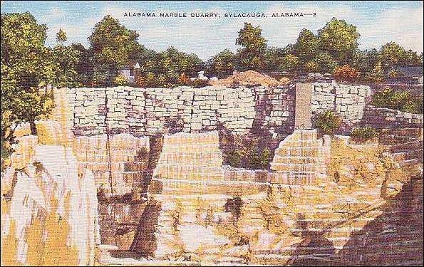
- Alabama Marble Quarry
(postcard photograph, #3, 13273N; A "Natural Color Card" made by E. C. Kropp Co., Milwaukee, Wis.; postmark May 9, 1953)
"The marble of this vicinity is beautifully colored in pastel shades of pinks, buffs, yellows, tans and light blues. A trip to these quarries is interesting and educational. Small lakes are formed in the deep caverns formed by the mining work."
- Sylacauga, Alabama – Alabama Marble Quarry, Sylacauga, Ala. (colorized postcard photograph; #3317; early 1900s; unmailed)
Alabama Marble Quarry, Sylacauga, Ala. (postcard photograph #3317, early 1900s) 
- Sylacauga, Alabama - Alabama Marble Quarry
(colorized postcard photograph #3309; Santway Photo-Craft Company, Watertown, N.Y.; postmark June 5, 1941) 
- Sylacauga, Alabama - Alabama Marble
Quarry (postcard photograph)
Alabama Marble Quarry (colorized postcard photograph, #2; mid-1900s; unmailed) 
-
Sylacauga (near), Talladega County, Alabama – Alabama Marble Company Quarry (postcard photograph; early 1900s; unmailed)
-
Sylacauga, Alabama – Alabama Marble Co., Inc. (Marble) (present-day company) 301 E Marble Valley Rd, Sylacauga, AL 35151
About Us (Alabama Marble Co., Inc.)
Marble has been quarried in Sylacauga since 1836. “The Sylacauga marble belt is 32 miles long, a mile and a half wide and up to 600 feet deep. It stretches from the Coosa River to southeast of Talladega…..” The Alabama Marble Co. Inc. was founded in 1998, and quarries white marble.
-
Sylacauga, Alabama – Alabama White Marble Company, Inc., 301 E. Marble Valley Road, Sylacauga, Alabama (present-day company)
According to the stonecontact.com web site, the marble colors quarried at the Alabama White Marble Company quarry are: Alabama White Cloud and Alabama White Statuary.
- Sylacauga (near), Alabama – “Alabama Marble Quarry” – Video showing an excavator pushing a large block of marble in the quarry (YouTube video by Alejandro Fernandez, August 19, 2008)
- Sylacauga (near), Alabama – Field trip to “Alabama Marble Company Quarry in Gantts Quarry Formation (Uppermost Lower Ordovician),” in From the Blue Ridge to the Coastal Plain; Field Excursions in the Southeastern United States, Geological Society of America, 2012.
On page 290, there is a description for a field trip to the “active dimension stone marble quarry of the Alabama Marble Co..." which can only be visited by permission. A geological description and map is included in this section. (A portion of this book is available on Google Books.)
- Sylacauga, Talladega County, Alabama – Sylacauga Marble Quarry (Present-day photograph of the Sylacauga marble quarry in the Encyclopedia of Alabama)


| “Main Stairway of Jewelers Building, Chicago, Illinois. F. P. Dinkelberg, Architect. Starrett-Dilks, Contractors. Standing marble Rose St. Genevieve trimmed with Red Levanto. Floors Roman Travertine. Marble finished and set in place by the Alabama Marble Company.” (Advertisement from Through The Ages, Vol. 5, No 8, December 1927, pp. 49) | 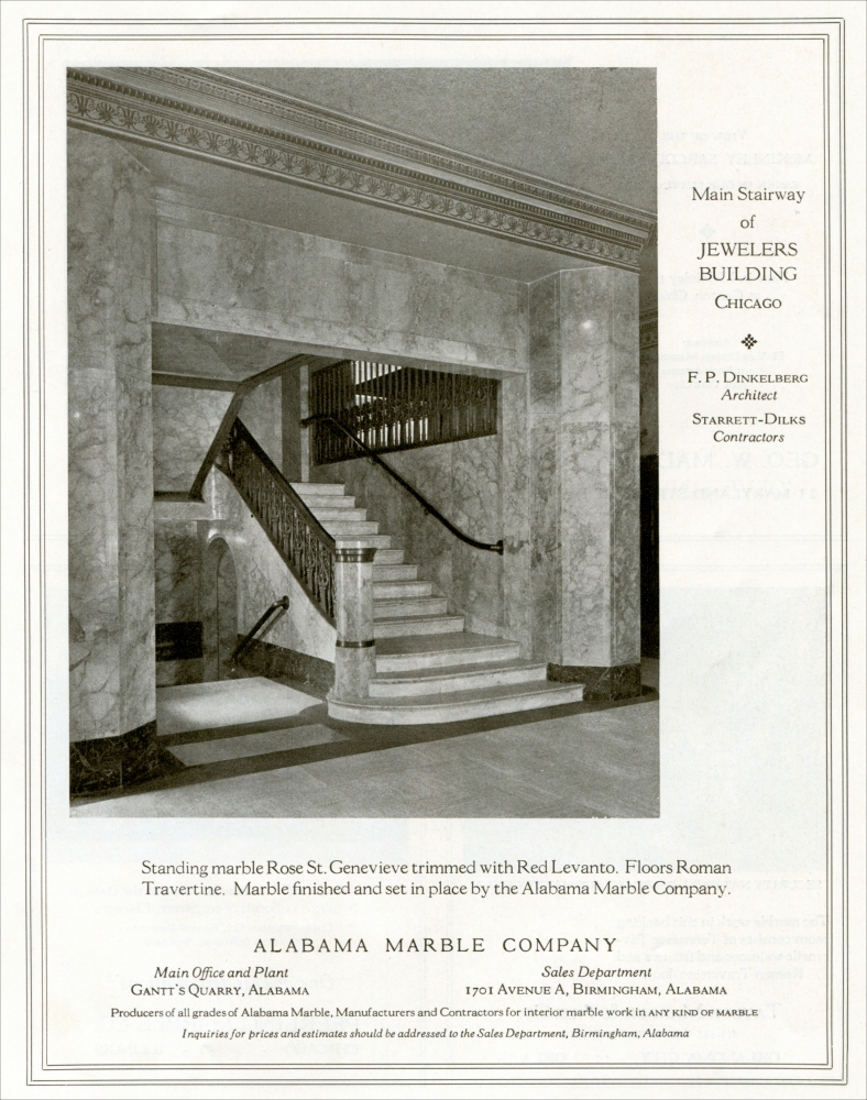 |

| Quarry, Alabama Marble Company, Sylacauga, Alabama (postcard photograph) |  |
Alabama White Marble Company quarry is described as: “The Alabama marble has been quarried in Sylacauga since 1836. The Sylacauga marble belt is 32 miles long, a mile and a half wide and up to 600 feet deep. It stretches from the Coosa River to southeast of Talladega.”
- Sylacauga (near), Talladega County, Alabama – the
Bowie’s Marble Quarry (Marble), from A brief
history of Sylacauga Marble, by Ruth Beaumont Cook, B. B.
Comer Memorial Public Library Foundation, 2009, pp. 5.
This quarry was listed in the above book as one of the small quarries that operated near Sylacauga in the middle of the 1800s.
- Sylacauga, Alabama – Gantt’s Quarry of
Alabama White Marble Co., Sylacauga, Ala.
(colorized postcard photo, R-51386; Post Card Exchange, Publishers, Birmingham, Ala.; Made in U.S.A.; early 1900s; unmailed) 
- Sylvacauga (near), Alabama - Gantt’s Quarry
Also see: Sylacauga (near), Alabama - Alabama Marble Company Quarry above.
-
Sylacauga (near), Alabama – the Gantt’s Marble Quarry – “Alabama Marble: History, Production and Use,” Mine and Quarry, pp. 246-251. (photo captions: “Gantt’s Quarry, Alabama (p. 246); “Quarry blocks of Alabama marble.” (p. 247); “Quarry of Alabama White Marble Co., Gantt’s Quarry, Alabama, showing Single- and Double-Head Sullivan ‘2’ Channelers.” (p. 248); “Sullivan Side-Hill Channeler, ‘Class 6 1/2,’ in West Rutland quarry of Vermont Marble Co. Instead of winding the cable on a drum on the axle, as described in this article, the cable here passes over a sheave and is attached to a counterbalance car running on rails parallel to the machine track.” (p. 249); “Part of the mill and shipping yard, Alabama Marble Co.” (p. 250)] (available on Google Books)
- Sylacauga (near), Alabama - the Gantt’s Marble
Quarry Division (from Preliminary Report on The
Crystalline and Other Marbles of Alabama, Bulletin
18,” by William F. Prouty, Geological Survey of Alabama,
1916, pp. 70-75)
Plate XI. View looking nearly east into the quarry of the Alabama Marble Co., at Gantt’s Quarry. Fifteen layers of marble have been utilized in this opening. The dip of the rocks is approximately 36 degrees. The third marble layer from the top was apparently a slipping zone and is marked by solution cavities. The new development tunnels from which, at the present time, practically all the marble for sale is being taken, were put down along this weaker layer. The buildings in the background constitute a portion of the marble finishing plant. (This description is from pp. 144-145 of Bulletin 18.)

Plate XII. View looking nearly west into quarry of Alabama Marble Co. at Gantt’s Quarry, showing in the background the former method of quarrying by making the cuts respectively down the slope and at right angles to it. In the foreground can be seen the present method of quarrying diagonal to the strike and dip direction and parallel with the major jointing directions. This method assures a higher percentage of sound marble, since by its use the unsoundness in the quarry block is less likely to pass diagonally through the block. (This description is from pp. 146-147 of Bulletin 18.)

Plate XIII. Showing line of solution in the southeast wall of Gantt’s Quarry. Underground waters have been unusually active in this bed (bed 3 from top). It is possible that slipping has taken place between beds 3 and 4, thus affording a plane of weakness for the activity of underground waters. To the left of the picture, can be seen the mouth of one of the development tunnels, of which there are two at the present time. Both tunnels have been driven directly down the slope along the more or less open bed. (This description is from pp. 148-149 of Bulletin 18.)

Plate XXXII. A. A large percentage of the Alabama marble is used for interior decoration such as wainscoting, and the different varieties of the decorative stone are dependent in no small degree upon the direction in which the stone is cut, whether at a small or a large angle to the direction of color bands. The block in the photograph has been cut nearly parallel to the color bands so that the yellowish or greenish layers of impurity will appear on the polished face of the marble as cloudings rather than lines. This is one of 19 gangs of saws at the marble mill at Gantt’s Quarry. (This description is from pp. 186-187 of Bulletin 18.)

Plate XXXII. B. Lathe turning marble column in marble mill at Gantt’s Quarry. The marble is placed in the lathe and taken from it by crane through the room. (This description is from pp. 186-187 of Bulletin 18.)

Plate XXXIII. A. Corner of the finishing plant, showing lathe “roughing in” a cream-white fluted column. Gantt’s Quarry. (This description is from pp. 188-189 of Bulletin 18.)

Plate XXXIII. B. Showing cream-white fluted column segments on finishing tables. Gantt’s Quarry. (This description is from pp. 188-189 of Bulletin 18.)

Plate XXXIV. A view inside the finishing plant of the Alabama Marble Co., Gantt’s Quarry. The whole plant is run by electric power and each machine has its individual motor. The arrangement of the finishing plant is such that the marble passes through from the rough to the finished with the least possible handling. (This description is from pp. 190-191 of Bulletin 18.)

Plate XXXV. A large percentage of the smaller dimensional marble from the coping sheds is used for tiling. The view shows the tile storage yards at the Gantt’s Quarry finishing plant. There were 150,000 square feet of marble tile in the yard at the time. (This description is from pp. 192-193 of Bulletin 18.)

Gantt’s Quarry Division - Extent.
“This division includes the area between the elevation passing through the southeast part of Sylacauga and the watershed in the marble valley just southwest of Gantt’s Quarry. This division is over seven miles in length. In this division the area of the marble-bearing rocks reach their maximum width of a little over 1 ¼ miles.
Condition in Sylacauga.
“The ridge which passes diagonally through Sylacauga with a N. 30° E. strike is apparently cut off toward the south side of the valley by a fault which runs parallel with the southeastern side of the marble valley. This diagonal ridge is apparently for the most part dolomite, but on its west slope several wells in the city of Sylacauga have exposed a good grade of white marble. This condition holds both in the NE. and the SW. of the SE. of S. 29, T. 21, R. 4-E. Marble is reported from other places within the city limits of Sylacauga, as for example near the L. & N. Railroad track by the cotton mill in the NE. of the SW. of S. 29, T. 21, R. 4-E., and near the Central of Georgia tracks in the SE. of the NW. of S. 29, T. 21, R. 4-E.
“The large spring on the north side of town is in dolomite, but not very far from the dolomite-marble line.
“Just outside of the city limits in the SE. of SE. of S. 20, T. 21, R. 4-E., and in the SW. of the SE. of S. 30, T. 21, R. 4-E., marble is known to occur in wells.
“The marble underlying the central and southwestern portion of Sylacauga seems for the most part to be rather deeply buried. The well by the cotton mill is reported to have reached marble at a depth below the surface of 30 feet.
“Samples of the marble from wells in Sylacauga are white to cream-white, saccharoidal, similar in texture and color to the marble now being so much quarried in this area.
“On a hill just to the south of a colored church in the NW. of the SW. of S. 32, T. 21, R. 4-E., the marble has been uncovered by the roadside with strike approximately parallel with the south side of the marble valley. It is very probable that this marble has been brought up in a fault which runs parallel with a larger fault on the southeast side of the marble valley.
Southwest of Sylacauga.
“Between Sylacauga and Gantt’s Quarry the marble valley is for the most part nearly level, the exceptions being slightly elevated areas of somewhat deeper red soil, which have a general trend diagonally across the valley with a strike of about N. 35° E., while the strike of the valley through here is about N. 75° to 80° E. There is apparently much good marble underlying these flatter and lower areas. It is thought, however, that much of it is under rather heavy cover. There has been very little prospecting in the lands between the quarries in the neighborhood of Gantt’s, and the wells which are above mentioned in the neighborhood of Sylacauga.
“To the west of Gantt’s Quarry the low land narrows and is completely cut off by a diagonal elevation about half a mile southwest of the quarry. This ridge forms a water-shed which divides the streams flowing north and east through Gantt’s Quarry from those which flow towards the southwest and west, (mostly underground) by Averiett Springs. It is probable that this more elevated portion carries a greater amount of cherty material and is more dolomitic in its nature than the rock forming the lower lands both to the northeast and southwest. In this portion of the area there are no exposures of marble.
“In the Gantt’s Quarry division we find the center of the marble industry of the State. There are two companies at the present time getting out and shipping marble in large quantities, and two other companies which have prospected and blocked out a large quantity of good marble. One of these companies has also opened a quarry pit on high grade marble preliminary to active operations.”
[To read the section on the Alabama Marble Company Quarry in the Gantt Marble District, see:
Sylacauga (near), Alabama - the Alabama Marble Company Quarry and Mill in the Gantt’s Marble District
[To read the section on the Marble City Quarry Company Quarry, see:
Sylacauga (near), Alabama - the Marble City Quarry Company Quarry in the Gantt’s Marble District]
[To read the section on the Moretti-Hanah Marble Company Quarry, see:
Sylacauga (near), Alabama - the Moretti-Harrah Marble Company Quarry in the Gantt’s Marble District]
- Sylacauga (near), Alabama - the Eastern
Alabama Railway & the Gantt's Quarry, presented
on the Frograil
web site. (The quotation below is used with the permission
of the Webmater of this web site.)
Supplemental and Back-Up Data.
“History. Like all shortlines, a glimpse into its history makes the EARY much more understandable. This line was originally part of the Anniston & Atlantic Railroad that opened between Anniston and Talladega in February 1884, and then was extended on to Gantt's Junction at the marble quarry there in 1886. The line shortly came under Louisville & Nashville ownership (in 1890), and in 1891, was extended from Gantt's Junction to Calera, crossing the Coosa River, and connecting with the South & North Alabama Railroad.
“Today, only the tracks from Gantts ("Gantt's" is correct, but almost all map resources refer to this location as "Gantts") Junction to Talladega remain intact. The line west of Gantts Junction was abandoned when Lay Dam was built on the Coosa River (a very large river, which surprisingly few people outside of the immediate area have ever heard of!). The dam impoundment flooded the rail bridge, and it was not economically feasible to replace it. To the east of Talladega, the line was abandoned in the early 1970's.”
- Sylacauga (near), Talladega County, Alabama – Gantt’s
Quarry (Marble), from A brief history of Sylacauga
Marble, by Ruth Beaumont Cook, B. B. Comer Memorial Public
Library Foundation, 2009.
According to this book, Dr. Edward Gantt originally observed the high quality marble outcroppings near Sylacauga while working as an army surgeon with Andrew Jackson about 1813. It wasn’t until January 1948 when Gantt purchased quarry land near Sylacauga. The history of the Gantt marble quarry is included in this book. (A photograph of the Gantt’s Quarry dinky is one of the photographs included in this book relating to Gantt’s Quarry, pp. 24. There is a section on “Operations at Gantt’s Quarry” and “The Modern Marble Industry in Sylacauga.”)
- Sylacauga (near), Alabama - Gantt's Quarry
(color postcard photograph, 41417; Alabama Post Card Co., Bessemer, Ala. 35020; unmailed)
"This quarry produces some of the best building stone in the nation. It is the largest marble quarry in the world."
- Sylacauga, Alabama – “A View of Gants Quarry, Sylacauga, Alabama” (postcard photograph; early 1900s; unmailed)
- Sylacauga, Alabama - Gantts Quarry Photographs in the Historic American Buildings Survey/Historic American Engineering Record. The record indicates that there are 9 photographs of Gantts Quarry in the collection. The Alabama Marble Company is also listed in the entry.
- Sylacauga (near), Talladega County, Alabama - Geology of Gantt’s Quarry and the Sylacauga Marble , by A. S. Glover, Georgia Marble Company, Alabama Calcium Products Division, 1983. (Book)
- Sylacauga (near), Alabama – Alabama Marble Company Mining and Processing, by Robert S. Fousek and Mark G. Steltenpohl, Alabama Geological Society, 2010, pp. 76. The geology, mining methods, and processing of selected industrial minerals in northeastern Alabama. (2002) (Note, this is the first page of the document, which is available for a fee.)
- Sylacauga (near), Alabama – Alabama Marble Quarries Company Quarry (previously Gantt-Imerys Marble Quarry) (Preent-day photograph)
-
Sylacauga (west of), Alabama – Alabama Marble, by Don Lawler, on the restlessrocks.blogspot.com, October 2, 2008 (Includes several photographs of the only active quarry in the area and the Alabama Marble Company workshop.)
- Sylacauga, Alabama – Gantts Quarry ghost town – presented in the “Gantts Quarry, Alabama” section of Wikipedia.
Sylacauga Marble Quarry
“Sylacauga is called ‘The Marble City’ for its location atop a vast deposit of fine-quality marble. The mineral has been quarried from the area since settlers first arrived in the early nineteenth century and has been used in sculpture and architecture.”


| “A View of Gants Quarry, Sylacauga, Alabama” (postcard photograph) |  |
Present-day photograph of the Gantt-Imerys Marble Quarry by John Van Noate on Flickr.
- Sylacauga (northeast of), Alabama - the Herd Marble Quarry (from Preliminary Report on The Crystalline and Other Marbles of Alabama, Bulletin 18,” by William F. Prouty, Geological Survey of Alabama, 1916, pp. 66-70)
“Gantts Quarry is a quarry and ghost town in Talladega County, Alabama, United States. The population was 0 at the 2000 census… although it had seven residents as late as the 1998 population estimate.” (Photographs of abandoned houses, the old Gantts Quarry post office, and the old marble quarry are included in this article.)
- Sylacauga (northeast of), Alabama - the Herd Marble Quarry
Division (from Preliminary Report on The Crystalline
and Other Marbles of Alabama, Bulletin 18,” by
William F. Prouty, Geological Survey of Alabama, 1916, pp. 66-70)
Herd Quarry Division - Extent.
“Under this heading is included in the area lying between Tallaseehatchee Creek on the northeast and the elevation passing diagonally across the marble valley through the southeastern portion of the town of Sylacauga on the southwest. The only development of marble which has taken place in this area is at the old Herd Quarry in the NE. of the NE. of S. 22, T. 21, R. 4-E., and in another quarry about a quarter a little north of west, frequently spoken of as the Hickman Quarry.
[Please Note: For the sections on the Herd and Hickman quarries, see the individual entries on those quarries:
Sylacauga (northeast of), Alabama - Herd Marble Quarry (Marble)
Sylacauga (northeast of), Alabama - Hickman Marble Quarry (Marble)]
Faulting.
“From the similarity of the marble in the Herd and Hickman quarries, and the presence of the phyllite hill between with similar strike, it appears that the measures are here repeated by strike faulting. This is further borne out by the fact that the phyllite hill which forms the ridge between the two quarries, dies out both to the northeast and to the southwest. The disappearance of this hill is accounted for by decreasing throw of the fault, both to the northeast and to the southwest, so that the marbles which, in the locality of the quarries, are separated by the phyllite hill become again united. In the short course of this hill of about a mile, the hill has been offset by at least 4 nearly north and south parallel faults, two of which bound the Herd Quarry. (For probable conditions in this locality see Figure 24.)
Northeast of the Quarries.
“Within a half mile to the northeast and east of these quarries, the valley opens out to the width of over one-half mile, due to a local southward embayment of the Talladega phyllite, previously mentioned. In less than a mile to the northeast from the quarry, or a little to the west of the crossing of the Tallaseehatchee Creek, the valley is again narrowed by the closing in of the phyllites, both to the northeast and southwest.
“In the bottom lands between the Herd Quarry and Tallaseehatchee Creek, there are several exposures of marble. In the NE. of NW. of S. 23, T. 21, R. 4-E., a prospect pit shows a sugary marble with alternating blue and white bands. This marble has a strike of about N. 50° E. and a dip of about 30° E. to the east of this exposure about 100 feet, as I am told by an old resident, another exposure of marble with similar color could at one time be seen, which showed a strike direction a little more toward the north than the one just mentioned. In the N. ½ of S. 14, T. 21, R. 4-E. along Crooked Creek before it enters the Tallaseehatchee Creek, I am told there used to be several exposures of marble apparently similar to the marble last mentioned, and also like the marble which can now be seen on the west side of the marble valley at the crossing of the Tallaseehatchee Creek near the south line of S. 11, T. 21, R. 4-E. This is an exposure of sugary textured marble with bluish clouding and banding in a white background.
Southwest of the Quarries.
“About half a mile due west of Herd Quarry, or about a third of a mile southwest of the Hickman Quarry near Crooked Creek in the springy bottom land, can be seen a bluish marble, which is similar in appearance to the layer found immediately underlying the Talladega phyllite in both the Hickman and Herd quarries. From its location it is thought to be the same layer as that seen in the upper portion of the Hickman Quarry. It is also very probable that the springs at this point are caused by issuance of the ground water along the plane of the strike fault above-mentioned.
“The bottom land along Crooked Creek southwest from the quarries is apparently largely underlain by marble, as is also probably the case in the valley to the northeast of the quarries. The marble valley is approximately one-third mile in width for about a mile to the southwest of the Herd Quarry. At this point it widens on account of the dying out of a ridge of Cambrian ‘slate,’ which has a trend diagonal to that of the valley. Marble is known to occur in the bottom land in several places in S. 28, just to the east of Sylacauga. At the large spring in the SW. of the NE. of S. 28, T. 21-S., R, 4-E., it is approximately 9 feet below the surface and has an apparent strike of about N. 30-E. Other pits in the NE. of the SW. of S. 28 also show a marble at about the same depth as that at the spring. The material overlying the marble is apparently for the most part transported, as is shown by the material taken from the pits mentioned, which consists of gravel, sand and clay-loam. In one case a tree trunk was found at the bottom of the pit overlying the marble. The marble which occurs in these pits or springs is similar to that which occurs in the immediate neighborhood of the Herd Quarry, a white saccharoidal marble with some bluish bands and mottling.
“At the Sylacauga City spring, in the NE. corner of S. 32, T. 21, R. 4-E., there is poorly exposed a somewhat siliceous layer of marble with strikes apparently in a northeast direction.
“It can be said in general of the area lying between the Tallaseehatchee Creek and the hill which crosses the valley, cutting through the southeast side of Sylacauga, that there are, beside the two well-known quarries, sufficient exposures of the marble by pit or outcrop in spring or by branch to warrant extended prospecting. It is thought further that the marble lying in the bottom lands apparently undisturbed by faulting, and protected by soil cover from weathering agencies, will be found much less unsound than that which is exposed in the Herd Quarry where weathering agencies have been most active.”
- Herd Family Records located in the B. B. Comer Library Collection.
- Sylacauga (northeast of), Alabama - the Hickman Marble
Quarry (from Preliminary Report on The Crystalline
and Other Marbles of Alabama, Bulletin 18,” by
William F. Prouty, Geological Survey of Alabama, 1916, pp. 66-70)
Plate XXII. A. Phyllite-marble contact at Hickman Quarry. The marble here exposed immediately underneath the phyllite is apparently the same layer that immediately underlies the phyllite in the Herd Quarry about a quarter of a mile to the southeast across the strike, thus suggesting repetition by strike faulting, Fig. 24. (This description is from pp. 166-167 of Bulletin 18.)

Hickman Quarry.
“Immediately to the northwest of the Herd Quarry occurs a phyllite hill running parallel with the strike of the marble, and on the northwest side of this hill, about a quarter of a mile northwest of the Herd Quarry, is an exposure of marble. At one time this deposit was quarried and used for flux in the iron furnaces at Talladega. A railroad spur entered this quarry from the northeast along Crooked Creek. There are at this place about 30 feet of marble exposed with a strike of about N. 70° E., and a dip of about 25° to the southeast under the phyllite ridge which intervenes between the two marble quarries. The marble in this quarry appears to be the same as the top portion of the marble in the Herd Quarry just referred to. At the top there is the blue layer and below the whiter marble. In this quarry the contact between phyllite and marble is very well shown. This contact is a very irregular one (Plate XXII A), and there is strong evidence that the phyllite has been thrust-faulted over the marble, as is evidenced by slickensiding of the phyllite in the direction of dip, by fault breccia and by lenses of phyllite enclosed in marble near the contact.
“As the valley extends from 4 to 5 hundred feet to the northwest of the Hickman Quarry across the strike before encountering a phyllite on the west side of the valley, it is thought that the marble underlies most of this area.
Faulting.
“From the similarity of the marble in the Herd and Hickman quarries, and the presence of the phyllite hill between with similar strike, it appears that the measures are here repeated by strike faulting. This is further borne out by the fact that the phyllite hill which forms the ridge between the two quarries, dies out both to the northeast and to the southwest. The disappearance of this hill is accounted for by decreasing throw of the fault, both to the northeast and to the southwest, so that the marbles which, in the locality of the quarries, are separated by the phyllite hill become again united. In the short course of this hill of about a mile, the hill has been offset by at least 4 nearly north and south parallel faults, two of which bound the Herd Quarry. (For probable conditions in this locality see Figure 24.)"
- Sylacauga (near), Talladega County, Alabama – the
Lower Leak Marble Quarry (Marble), from A brief
history of Sylacauga Marble, by Ruth Beaumont Cook, B.
B. Comer Memorial Public Library Foundation, 2009, pp. 5.
This quarry was listed in the above book as one of the small quarries that operated near Sylacauga in the middle of the 1800s.
- Sylacauga (northeast of), Alabama - the Marble City Quarry
Company in Gantt’s Marble Quarry Division (from Preliminary
Report on The Crystalline and Other Marbles of Alabama,
Bulletin 18,” by William F. Prouty, Geological Survey
of Alabama, 1916, pp. 77-78)
Plate XXX. A. A typical sink in the marble. This one is shallow and has numerous small trees in it. The water collects in this basin after heavy rains, but is not long retained since the water-table is normally several feet below the surface, due to underground stream channels in the limestone. Near opening of Marble City Quarry Co. (This description is from pp. 182-183 of Bulletin 18.)

Marble City Quarry Company.*
[* Page 77 footnote: The Madras Marble Co., of 120 Broadway, N. Y., has recently taken over the holdings of the Marble City Quarries Co. (circa 1916)]
Location.
“This company is located in the NE. of the NE. of the SW. of Section 36, T. 21, R. 3-E. The quarry opening of this company is immediately to the northeast of the quarry of the Moretti-Harrah Marble Co., being only a few yards distant across the property line. The opening is on the same layers that are being worked in the Moretti-Harrah Marble Co.’s quarry.
Character and Thickness of Marble.
“At the present writing only enough blocks have been taken out to demonstrate the character of the marble which is similar to that in the other quarries located on these beds, but extensive core drilling of the tract to the east of this opening and to the east of the Moretti-Harrah Marble Co.’s quarry has been carried on with the result that a large amount of high grade marble has been blocked out. The marble for the most part in this immediate area is about 8 feet below the surface though in places erosion is much deeper, especially is this true in the area not far from the stream which passes through this and the adjoining property. Prospecting on this property with diamond drill and quarry opening reveals four divisions in the marble: a top, high grade marble whose upper limit has not been determined, 75 feet; second a layer of marble with more chloritic schist and some pyrite, about 7 feet; third a layer of high grade marble in which the quarry is opened, about 130 feet; and fourth a lower layer into which the drill passed about forty feet and which carries considerable schist. Analyses of the marble from the first third and fourth layers are as follows:
(Column headings for table below: a, b, c)
Silica 0.45, 0.27, 0.27
Alumina Trace Trace Trace
Iron oxide 0.05, 0.05, 0.05
Lime CaO 55.01, 55.12, 55.16
Magnesia MgO 0.42, 0.27, 0.39
Sulphuric anhydride 0.01, 0.01, 0.02
Carbonic CO2 43.28, 43.30, 43.40
“a. First bed of marble sample taken from core from 37 feet below surface to 50 feet below surface exclusive of the schistose bands.
“b. Third bed of marble, sample taken from core 74 feet to 99 feet below the surface, all inclusive.
“c. Lower layer of marble, sample taken from core from depth 69 feet to 83 feet below the surface, all inclusive.
“The above analyses taken from the report on the marble property by Ricketts and Banks, shows the marble to be exceptionally pure. The cross-section (Figure 15) applies to this area.”
- Sylacauga (near), Talladega County, Alabama – the
McKenzie Blue Marble Quarry (Marble), from A brief
history of Sylacauga Marble, by Ruth Beaumont Cook, B. B.
Comer Memorial Public Library Foundation, 2009, pp. 5.
This quarry was listed in the above book as one of the small quarries that operated near Sylacauga in the middle of the 1800s. (A photograph of the McKenzie Blue Quarry circa 1916 taken from a 1916 report available on Google Books is included in this book.)
- Sylacauga (near), Talladega County, Alabama – the
McKenzie White Marble Quarry (Marble), from A brief
history of Sylacauga Marble, by Ruth Beaumont Cook, B. B.
Comer Memorial Public Library Foundation, 2009, pp. 5.
This quarry was listed in the above book as one of the small quarries that operated near Sylacauga in the middle of the 1800s.
- Sylacauga (northeast of), Alabama - the Moretti-Harrah Marble Company in Gantt’s Marble Quarry Division (from Preliminary Report on The Crystalline and Other Marbles of Alabama, Bulletin 18,” by William F. Prouty, Geological Survey of Alabama, 1916, pp. 75-77)
- Sylacauga (near) Talladega County, Alabama – the Moretti-Harrah Marble Company – Advertisement by Tompkins-Kiel Marble Company, their stone distributor, in New York City, New York (from The Monumental News, October 1919, pp. 737)
Alabama Marble for Monumental Work
To the Dealers: We beg to call your attention to the products of the Moretti-Harrah Marble Company, whom we represent in the sale of their white Alabama Marble.
The marble from this quarry is becoming better known every day. The inquiries that we are receiving and the orders we are filling indicate to us that same is meeting with great favor.
Manufacturers: We are appealing to independent manufacturers, by this we mean manufacturers who have invested their money in the erection of plants, machinery, etc., to favor us with their inquiries for White Alabama Marble. Remember, we in no way compete with you, and we do not manufacture, and our policy has always been to co-operate with the independent manufacturers, by maintaining as low and as steady prices as possible.
We can fill your orders with rough quarried blocks or blocks sawn one way. If stock is required, sawed to size or finish, we beg to refer you to,
Candora Marble Company, Knoxville, Tennessee
Albert Weiblein Marble & Granite Co., New Orleans, Louisiana
Reed Bros. Stone & Monumental Works, Birmingham, Alabama
Hilgartner Marble Co., Baltimore, Marylandfor prices. These concerns have a large stock of blocks on hand and can give you very attractive prices. Samples will be forwarded to you upon request.
- Sylacauga (near), Talladega County, Alabama – the
Moretti-Harrah Marble Company Quarry (Marble), from A
brief history of Sylacauga Marble, by Ruth Beaumont Cook,
B. B. Comer Memorial Public Library Foundation, 2009, pp. 16,
18.
The Moretti-Harrah Marble Company was originally owned and operated by GiuseppeMoretti and Charles Jefferson Harrah. The quarry was located less than a mile from Gantt’s Quarry. About 1915, Charles Harrah sold his interest in the Moretti-Harrah Marble Company to Tompkins-Kiel, a New York firm. In 1935 Tompkins-Kiel sold the Moretti-Harrah Company to B. F. Coggins of Atlanta and T.A. McGahey of Columbus, Mississippi .
- Moretti Collection located in the Archives of the Birmingham Public Library.
- Sylacauga (northeast of), Alabama - the
Moretti-Harrah Marble Company (Book)
Modern Memorial Designs: America's Most Beautiful White Marble, written and published by Moretti-Harrah Marble Corp., Sylacauga, Alabama, 1936.
-
Sylacauga, Alabama – Giuseppi Moretti – Marble Quarry, 1935 (Photograph in the Encyclopedia of Alabama)
Marble Quarry, 1935
“During the early twentieth century, Italian sculptor Giuseppe Moretti, whose first contribution to Alabama was the Vulcan statue in Birmingham, used Sylacauga marble for a number of his works. During the 1930s the marble industry fought the Great Depression and saw larger operations such as the Alabama Marble Company absorb smaller ones.”
- Sylacauga (near), Talladega County, Alabama – Sims & Gants
Marble Quarry (Marble), from A brief history of
Sylacauga Marble, by Ruth Beaumont Cook, B. B. Comer Memorial
Public Library Foundation, 2009, pp. 2.
This book indicates that Dr. Edward Gantt was associated with this quarry, “…which was later incorporated on (the village of Gantt’s Quarry) very edge.”
- Sylacauga (near), Talladega County, Alabama – Simms,
Gant & Co., Marble Quarry (Marble), from A brief
history of Sylacauga Marble, by Ruth Beaumont Cook, B. B.
Comer Memorial Public Library Foundation, 2009, pp. 3.
This book indicates that the Simms, Gant & Co. marble quarry was associated with Dr. Edward Gantt in 1837.
- Sylacauga, Alabama - Sylacauga Quarry (present-day quarry), 772 Gantts Lane, Sylacauga, Alabama 35151; (facility) (256) 245-6408; (sales) (205) 969-2629.
Plate XIX. B. Looking from phyllite ridge across narrow valley to Herd Quarry. The valley here is repeated by strike faulting and the exposure of marble in Herd Quarry is the result of an uplift of fault-block. Hickman Quarry is back of the camera on west side of phyllite ridge. For probable structure here see Fig. 24. (This description is from pp. 160-161 of Bulletin 18.) |
 |
Herd Quarry.
“The exposure of marble in the Herd Quarry is one of the few natural exposures in the marble area. It appears to be a fault block which forms a prominent knoll on the side of the slate mass to the east, and under which the marble dips at an angle of about 30°. The strike of the marble at this locality is about N. 60° E., and unless the strike of the marble changes considerably more toward the east, northeastwardly from here, which it does not appear to do, this particular marble bed must diverge from the slate hill which bounds it on the east at the quarry, and must extend out into the bottom lands a considerable distance to the northwest from the Talladega phyllite in the embayment which occurs a little to the northeast of the quarry. This divergence of strike of marble and line between valley and phyllite hill, suggests at this point a diagonal reverse fault between phyllite and marble.
“Immediately below the Talladega phyllite in the Herd Quarry, occurs a dark blue marble for several feet. Below this layer, as seen in the quarry itself for about 60 feet, and in a core taken from the quarry for about 100 feet, the marble has no heavy blue layers, but is white to white clouded, and white with blue veining. The general character of the marble is similar to that at Gantt’s Quarry. It has a sugary texture, and a number of schistose (talcose) layers. The blue clouding is not a constant bedding characteristic, as the marble is found to become blue or white as seen in different places in the same bed.
“As would be expected from the position of the quarry (the rock is unusually exposed to the weathering agents) and from the fact that the marble has faulted up, there is much unsoundness in the stone, as is shown by rather numerous joints, slicks, and cutters. The thickness of the deposit at this quarry is not known, but the surface indications would lead one to believe that it is at least 200 feet, and probably more....”
Faulting.
“From the similarity of the marble in the Herd and Hickman quarries, and the presence of the phyllite hill between with similar strike, it appears that the measures are here repeated by strike faulting. This is further borne out by the fact that the phyllite hill which forms the ridge between the two quarries, dies out both to the northeast and to the southwest. The disappearance of this hill is accounted for by decreasing throw of the fault, both to the northeast and to the southwest, so that the marbles which, in the locality of the quarries, are separated by the phyllite hill become again united. In the short course of this hill of about a mile, the hill has been offset by at least 4 nearly north and south parallel faults, two of which bound the Herd Quarry. (For probable conditions in this locality see Figure 24.)....”


Plate XV. Early stage in the development of the Moretti-Harrah Marble Co.’s quarry, showing channeling machine cutting “with the dip.” The smoke in the middle background rising above the freight car, is from Gantt’s Quarry, three-quarters of a mile distant, diagonally across the marble valley (see map frontispiece for relations). (This description is from pp. 152-153 of Bulletin 18.) |
 |
| Plate XIV. Moretti-Harrah Marble Co. Quarry, September, 1914. Shows newly stripped area for extending quarry. Cover here is 5-8 feet thick. On left, wire saw is seen trimming blocks preparatory to their shipment. Studio of G. Moretti in the right background. The opening of the Marble City Quarry Co. is just to the left of this picture. View looking approximately in line of strike. Gantt’s Quarry in the distance a little to left of the studio. (This description is from pp. 150-151 of Bulletin 18.) |  |
| Plate XVI. View from southwest corner of the quarry pit, Moretti-Harrah Marble Co., showing development in fall of 1916. (This description is from pp. 154-155 of Bulletin 18.) |  |
Plate XXVIII. Showing common method of keeping marble cores in boxes for future study. Each piece of the core is marked at both ends with progressive numbers as: 1-2, 2-3, 3-4, etc., on the same side of core. The marble shown in this core is for the most part a cream-white with occasional chlorite or talcose clouding or banding. From quarry of Moretti-Harrah Marble Company. (This description is from pp. 178-179 of Bulletin 18.) |
 |
Moretti-Harrah Marble Company - General Setting.
“The quarry of this company is located about three-fourths of a mile north 33° E. from Gantt’s Quarry in the NW. of the NE. of SW. of S. 36, T. 21, R. 2-E. The quarry was opened in 1912 in the proximity of a bold spring which flowed from the marble, exposing it at this point. Operation of the quarry has been continuous since it was opened, and it is now (circa 1916) being developed in an opening about 280 feet long and 90 feet wide. (See photograph Plate XVI.)
“A spur track, one-half mile in length, connects the quarry with the Louisville and Nashville Railroad. All the marble from this quarry is shipped to New York City in block form, and is loaded direct from the quarry to the car by derrick, or, in case the blocks are rough, they are first trimmed by means of a wire saw apparatus before they are loaded for shipment.
“The electrical transmission line of the Alabama Power Co. passes directly by the quarry, as it does also by the other marble quarries in the southwestern part of the marble area, thus cheap electrical power can be had to take the place of the steam plants, or to be used as an auxiliary.
Character of Marble.
“Marble in this quarry is of excellent grade. Much of it is a beautiful cream white, and is thought to correspond to some of the lower layers in the Gantt’s Quarry of the Alabama Marble Co. (For photomicrograph of this marble see Plate II A.) This identity of the marble in the two quarries can be explained by a gradual change in the strike of the marble between the two quarries. This seems very probably the case, since the strike of the marble in the east end of Gantt’s Quarry is about N. 40 ° E., and in the Moretti-Harrah Company’s quarry about N. 28° E., with the bearing from the Gantt’s Quarry to the Moretti-Harrah Quarry, as already stated, N. 33° E. The identity of these marbles could also be explained by an offset of fold and sudden change of strike somewhat between the two quarries.
Structural Conditions.
“The dip of the marble in the Moretti-Harrah Quarry is slightly less than in the Gantt’s opening, being on an average a little less than 30°. The jointing planes run for the most part with the dip and strike, but there are occasional well-defined diagonal joints which have a tendency to decrease the amount of available sound blocks taken out with cuts parallel to and perpendicular to the strike.
“In some of the layers there is marked evidence of drag-folding. (See Figure 18; also Plate XXVI B.) This is seen in the arching of the lines of schist or color in the blocks. Frequently there is a difference of as much as 15° between the line of schist in the block and the apparent bedding plane, which is the plane of parting taken advantage of in removing the marble.
Neighboring Marble Land.
“Prospecting has been done to the south and southwest of the present quarry, and a good supply of high grade marble is known to be available. The soil cover through here averages from 5 to 7 feet in thickness, and for the most part a buff-colored, more or less gravelly clay-loam which has been in large part transported by the surface streams.
“Prospecting to the west of the Moretti-Harrah Marble Co.’s quarry shows that the marble is bordered in that direction by a dolomite similar to the one bordering the marble on the west at the Alabama Marble Co.’s quarry (Gantt’s Quarry). To the southeast of the quarry the comparatively level land continues for a mile or more (see cross-section, Figure 15). To the east of this quarry is the property of the Marble City Quarry Co., whose land has been thoroughly core drilled, mention of which will be made elsewhere. Immediately to the south of the property of the Moretti-Harrah Co. a number of borings into the marble have been made on the property of Sidney Hiller.”
| Moretti-Harrah Marble Company – Advertisement by Tompkins-Kiel Marble Company, their stone distributor, in New York City, New York (from The Monumental News, October 1919, pp. 737) (photo caption in advertisement) “Quarries at Sylacauga, Alabama”) |  |
Commercial use of material within this site is strictly prohibited. It is not to be captured, reworked, and placed inside another web site ©. All rights reserved. Peggy B. and George (Pat) Perazzo.